DocWMTSExamples - Maproom/qmapshack GitHub Wiki
Prev (WMS Examples) | Home | Manual | Index | (Elevation (DEM) data) Next
Table of contents
A WMTS service does not offer the flexibility of free scale selection; it offers instead faster loading time by using static tiles with fixed and discrete scales. This fixed structure of tiles allows the use of a WMTS service with a web server that simply retrieves the available files.
The use of WMTS services in QMS has been described in sections "Basic procedure for using WMTS or TMS files" and "What requirements must a WMTS file fulfill?".
This page shows more examples of WMTS services. The purpose of these examples is to show how WMTS services can be used through TMS files. Such TMS files have some advantages over WMTS files in QMS, among them
- better control and handling of the layers to be drawn in QMS
- WMTS services that support only KVP operations can be used
- the order of tile matrix sets in a capabilities file is of no importance
- the possibility to use extra URL fields like
Timedescribed in the optionalDimensionsbranch of a layer in the capabilities file.
Most of the WMTS files discussed in the examples can be used directly in QMS, too.
A TMS file can be successfully built for a WMTS layer and used in QMS if
- the layer is linked to a tile matrix set supporting the coordinate reference system (CRS) EPSG:3857 or one of its equivalents (a known one is EPSG:900913)
- this tile matrix set is a so-called GoogleMapsCompatible tile matrix set
- each tile matrix of the set has tile width and tile height of 256
One purpose of the examples is to give sufficient information to compose the necessary TMS files for accessing WMTS services. Normally, other layers than the mentioned ones of the same service can be reached by simply replacing the layer name within the shown URL with a different one.
The examples should also help users to build TMS files for other WMTS services.
Each example consists of the following information
- Layer: name of the WMTS layer
- TileMatrixSet: name of the WMTS tile matrix set used for getting the snapshot
- TileMatrix: name of the tile matrix (the zoom level) used for getting the snapshot
- Zoom correction: When calling a TMS file QMS assumes that tile matrices have a numeric identifier (zoom level). There are WMTS services where this requirement is not satisfied. In some cases, the zoom level sent to the TMS file can be corrected within the TMS file to get a correct tile matrix name. The line shown carries out this correction.
- URL used for snapshot: complete request URL used for getting the snapshot from the server
- TMS request URL: complete request URL for use in a TMS file.
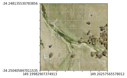
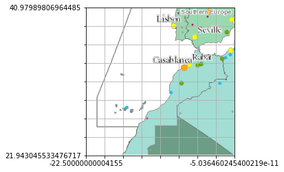
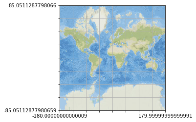
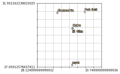
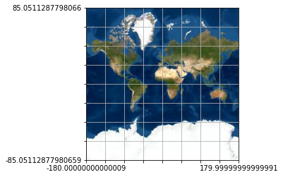
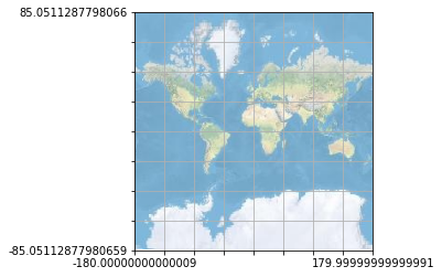
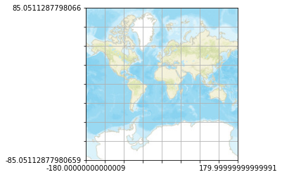
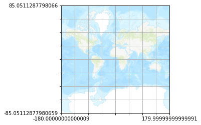
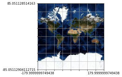
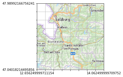
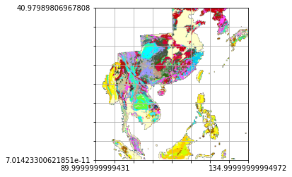
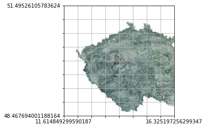
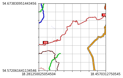
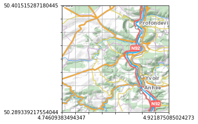
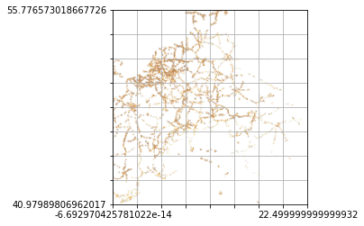
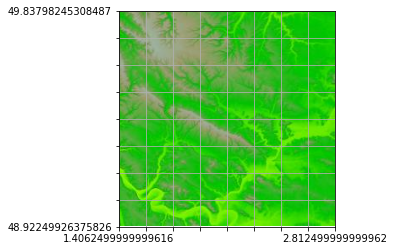
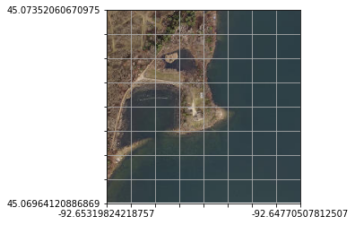
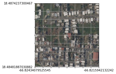
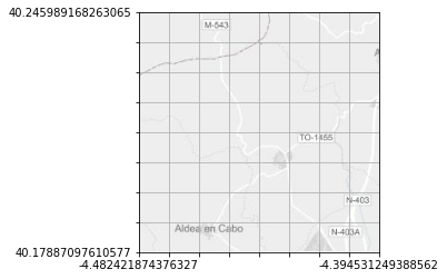
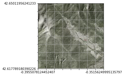
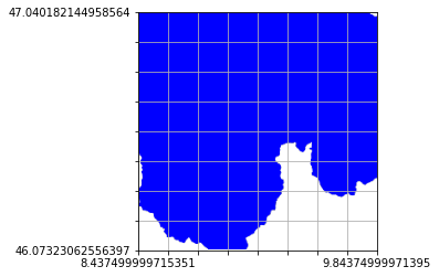
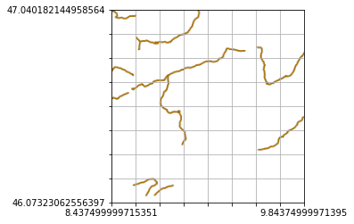
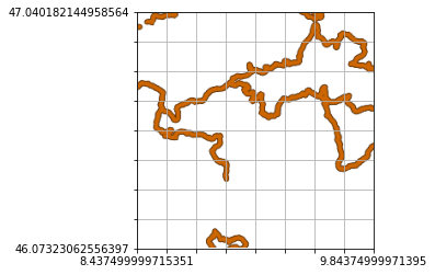
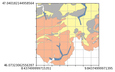
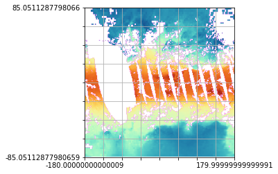
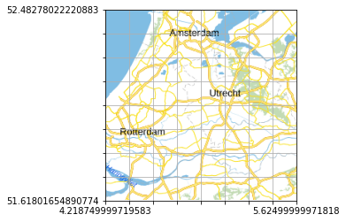
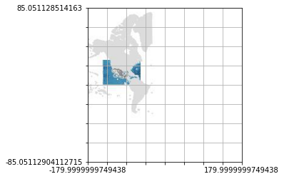
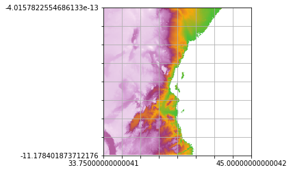
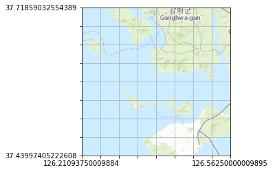
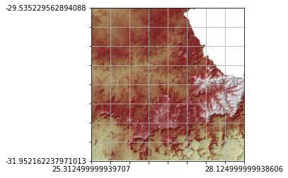
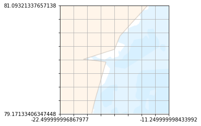
- 256*256 pixel snapshot: The shown snapshot was obtained directly by a request from the WMTS server. No geographic projection was applied to the snapshot. Thus, some snapshots are distorted. The correct layout can be seen when using the service in QMS. Labels at the axes show the geographic location of the tile.
For reasons of space, details about the service and the layer content are not given. These can be obtained from the WMTS capabilities file belonging to the URL.
Remarks:
-
WMTS services may fail in QMS for various reasons, among them: capabilities files out of spec or with data errors, access restrictions on the server, coordinate systems not supported by QMS, missing resource URL, etc.
-
Depending on the used computer screen size some of the zoom levels in the examples may be not supported in QMS map windows.
-
Some snapshots are made with zoom level 0 (i.e. with tile matrix 0). On this zoom level, there is only 1 tile. In some cases, the proper content of this tile is difficult to find in the snapshot. In this case, it is recommended to change the zoom level of the request as follows:
- increase, for instance, the zoom level by 3, i.e. go from zoom level 0 to zoom level 3. On this new zoom level, each axis is split into 2**3 = 8 parts.
- identify a tile that has some content by its zero-based row and column number in the shown grid obtained by splitting the axes
- change the name (number) of the tile matrix and insert the wanted row and column numbers in the request URL for the snapshot
- get a new snapshot by calling the new URL
Here is an example:
-
Original snapshot URL:
https://gbank.gsj.jp/tilemap/geologicmap/wmts/1.0.0/EASIA_CCOP_2M_Combined_BLT_SLT_BA/default/EPSG900913/00/0/0.png -
New snapshot URL (pointing to the highlighted tile in the original image):
https://gbank.gsj.jp/tilemap/geologicmap/wmts/1.0.0/EASIA_CCOP_2M_Combined_BLT_SLT_BA/default/EPSG900913/03/3/6.png -
Original and zoomed snapshots:

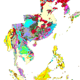
This approach was used during the preparation of the snapshots below.
-
If a WMTS server supports RESTful operations, then the server may use any possible order of the variables and values in the resource URL template. Therefore, the meaning of a slash-separated field in an URL can not be found from its position. It must be found at the same position in the resource URL template of the capabilities file. This is essential when building the tile row and column parts of an URL in a TMS file.
-
If a WMTS server supports KVP operations, then the order of the key-value pairs is arbitrary.
-
Some WMTS offer time-dependent data using a
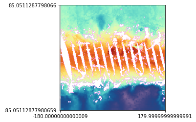
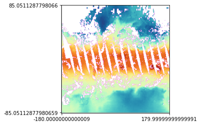
TIMEparameter. Here is an example showing snapshots of the same location at different dates: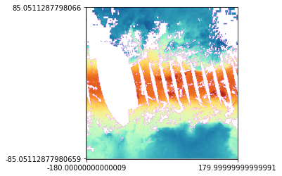

The first of these tiles was obtained with the request URL
  https://gibs.earthdata.nasa.gov/wmts/epsg3857/best/wmts.cgi?SERVICE=WMTS&REQUEST=GetTile&VERSION=1.0.0&
  LAYER=AIRS_L2_Surface_Air_Temperature_Day&STYLE=default&TILEMATRIXSET=GoogleMapsCompatible_Level6&
  TIME=2003-01-30&TILEMATRIX=0&TILEROW=0&TILECOL=0&FORMAT=image/png
The other dates in the
TIMEparameter are2003-04-30, 2003-08-30, 2003-12-30.Information about feasible times and the periodicity is part of the capabilities file (
Dimensionbranch of a layer in the capabilities file). -
Several examples belonging to the SwissTopo server
wmts.geo.admin.chillustrate the broad range of possible contents of WMTS files. -
The URL in the example using the French
wxs.ign.frserver has to be prepared especially: to get results you must have a username, a password, and an access key and insert them instead of the templates shown in the URL. If there are non-ASCII characters in the username or password, then the username or password must be encoded using%xxescapes. -
Quite often WMTS capabilities files support a tile matrix set identified by
default028. Such tile matrix sets may support different CRS and may have different tile matrix features. Some of them areGoogleMapsCompatiblebut this must be checked carefully. The examples below with support for adefault028mmtile matrix set passed this check, i.e., they areGoogleMapsCompatible. -
The last example shown is for the WMTS orthophoto service of
maps.ottawa.caand is a special case of the use of adefault028mmtile matrix set. This tile matrix set supports EPSG:3857 but the tile matrices are not the ones used in aGoogleMapsCompatibletile matrix set. Comparing both sets reveals that the tile matrix identifiers differ by a constant 9. Using the special zoom correctionz1 = z1 -9maps tiles from one tile matrix set to the other one correctly.The second tile matrix set
GoogleMapsCompatibleof this WMTS file meets the requirements for a TMS file without zoom corrections but the server does not return tiles when using this tile matrix set. This example is included on this page as a reminder that the structure of the tile matrix set has to be compatible with the GoogleMapsCompatible well-known scale set for the CRS EPSG:3857 and that the server may fail to return data for a declared tile matrix set.
<TMS>
<Layer idx="0">
<Title>TMS for WMTS example</Title>
<Script><![CDATA[(
function convert(z1,x1,y1)
{
<tmzoom>
return <request_url>
}
)]]></Script>
</Layer>
<Copyright>see capabilities file belonging to URL</Copyright>
</TMS>
In this template replace
-
<tmzoom>with the expression shown in the "Zoom correction" line, -
<request_url>with the URL shown in the "TMS request URL" line of the example (without line breaks and using quotes as shown).
-
Layer: web
-
TileMatrixSet: WEBMERCATOR
-
TileMatrix: 00
-
Zoom correction:
if (z1 < 10) {z1 = "0" + z1}; -
URL used for snapshot:
https://sgx.geodatenzentrum.de/wmts_topplus_open/tile/1.0.0/web/default/WEBMERCATOR/00/0/0.png -
TMS request URL:
"https://sgx.geodatenzentrum.de/wmts_topplus_open/tile/1.0.0/web/default/WEBMERCATOR/"+z1+"/"+y1+"/"+x1+".png" -
256*256 pixel snapshot:
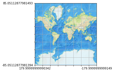
-
Layer: IGNBaseTodo
-
TileMatrixSet: GoogleMapsCompatible
-
TileMatrix: 0
-
Zoom correction:
z1 = z1; -
URL used for snapshot:
https://www.ign.es/wmts/ign-base?SERVICE=WMTS&REQUEST=GetTile&VERSION=1.0.0&LAYER=IGNBaseTodo&STYLE=default&TILEMATRIXSET=GoogleMapsCompatible&TILEMATRIX=0&TILEROW=0&TILECOL=0&FORMAT=image/jpeg -
TMS request URL:
"https://www.ign.es/wmts/ign-base?SERVICE=WMTS&REQUEST=GetTile&VERSION=1.0.0&LAYER=IGNBaseTodo&STYLE=default&TILEMATRIXSET=GoogleMapsCompatible&TILEMATRIX="+z1+"&TILEROW="+y1+"&TILECOL="+x1+"&FORMAT=image/jpeg" -
256*256 pixel snapshot:
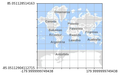
-
Layer: norgeskart_bakgrunn
-
TileMatrixSet: EPSG:3857
-
TileMatrix: EPSG:3857:14
-
Zoom correction:
z1 = "EPSG:3857:" + z1; -
URL used for snapshot:
http://opencache.statkart.no/gatekeeper/gk/gk.open_wmts?SERVICE=WMTS&REQUEST=GetTile&VERSION=1.0.0&LAYER=norgeskart_bakgrunn&FORMAT=image/png&STYLE=default&TILEMATRIXSET=EPSG:3857&TILEMATRIX=EPSG:3857:14&TILEROW=4723&TILECOL=8432 -
TMS request URL:
"http://opencache.statkart.no/gatekeeper/gk/gk.open_wmts?SERVICE=WMTS&REQUEST=GetTile&VERSION=1.0.0&LAYER=norgeskart_bakgrunn&FORMAT=image/png&STYLE=default&TILEMATRIXSET=EPSG:3857&TILEMATRIX="+z1+"&TILEROW="+y1+"&TILECOL="+x1 -
256*256 pixel snapshot:

-
Layer: mtn50-edicion1
-
TileMatrixSet: GoogleMapsCompatible
-
TileMatrix: 14
-
Zoom correction:
z1 = z1; -
URL used for snapshot:
https://www.ign.es/wmts/primera-edicion-mtn?SERVICE=WMTS&REQUEST=GetTile&VERSION=1.0.0&LAYER=mtn50-edicion1&FORMAT=image/jpeg&STYLE=default&TILEMATRIXSET=GoogleMapsCompatible&TILEMATRIX=14&TILEROW=6220&TILECOL=8311 -
TMS request URL:
"https://www.ign.es/wmts/primera-edicion-mtn?SERVICE=WMTS&REQUEST=GetTile&VERSION=1.0.0&LAYER=mtn50-edicion1&FORMAT=image/jpeg&STYLE=default&TILEMATRIXSET=GoogleMapsCompatible&TILEMATRIX="+z1+"&TILEROW="+y1+"&TILECOL="+x1 -
256*256 pixel snapshot:
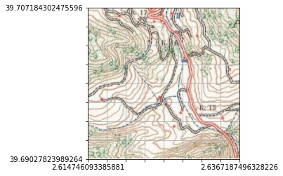
-
Layer: ORTHOIMAGERY.ORTHOPHOTOS
-
TileMatrixSet: PM
-
TileMatrix: 0
-
Zoom correction:
z1 = z1; -
URL used for snapshot:
https://wxs.ign.fr/pratique/geoportail/wmts?SERVICE=WMTS&REQUEST=GetTile&VERSION=1.0.0&LAYER=ORTHOIMAGERY.ORTHOPHOTOS&STYLE=normal&TILEMATRIXSET=PM&TILEMATRIX=0&TILEROW=0&TILECOL=0&FORMAT=image/jpeg -
TMS request URL:
"https://wxs.ign.fr/pratique/geoportail/wmts?SERVICE=WMTS&REQUEST=GetTile&VERSION=1.0.0&LAYER=ORTHOIMAGERY.ORTHOPHOTOS&STYLE=normal&TILEMATRIXSET=PM&TILEMATRIX="+z1+"&TILEROW="+y1+"&TILECOL="+x1+"&FORMAT=image/jpeg" -
256*256 pixel snapshot:
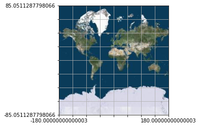
-
Layer: public_NSW_Imagery
-
TileMatrixSet: default028mm
-
TileMatrix: 17
-
Zoom correction:
z1 = z1; -
URL used for snapshot:
http://maps.six.nsw.gov.au/arcgis/rest/services/public/NSW_Imagery/MapServer/WMTS/tile/1.0.0/public_NSW_Imagery/default/default028mm/17/78822/119858 -
TMS request URL:
"http://maps.six.nsw.gov.au/arcgis/rest/services/public/NSW_Imagery/MapServer/WMTS/tile/1.0.0/public_NSW_Imagery/default/default028mm/"+z1+"/"+y1+"/"+x1 -
256*256 pixel snapshot:
-
Layer: WorldTimeZones
-
TileMatrixSet: default028mm
-
TileMatrix: 4
-
Zoom correction:
z1 = z1; -
URL used for snapshot:
http://sampleserver6.arcgisonline.com/arcgis/rest/services/WorldTimeZones/MapServer/WMTS/tile/1.0.0/WorldTimeZones/default/default028mm/4/6/7.png -
TMS request URL:
"http://sampleserver6.arcgisonline.com/arcgis/rest/services/WorldTimeZones/MapServer/WMTS/tile/1.0.0/WorldTimeZones/default/default028mm/"+z1+"/"+y1+"/"+x1+".png" -
256*256 pixel snapshot:
-
Layer: NatGeo_World_Map
-
TileMatrixSet: GoogleMapsCompatible
-
TileMatrix: 0
-
Zoom correction:
z1 = z1; -
URL used for snapshot:
http://services.arcgisonline.com/arcgis/rest/services/NatGeo_World_Map/MapServer/WMTS?SERVICE=WMTS&REQUEST=GetTile&VERSION=1.0.0&LAYER=NatGeo_World_Map&STYLE=default&TILEMATRIXSET=GoogleMapsCompatible&TILEMATRIX=0&TILEROW=0&TILECOL=0&FORMAT=image/jpeg -
TMS request URL:
"http://services.arcgisonline.com/arcgis/rest/services/NatGeo_World_Map/MapServer/WMTS?SERVICE=WMTS&REQUEST=GetTile&VERSION=1.0.0&LAYER=NatGeo_World_Map&STYLE=default&TILEMATRIXSET=GoogleMapsCompatible&TILEMATRIX="+z1+"&TILEROW="+y1+"&TILECOL="+x1+"&FORMAT=image/jpeg" -
256*256 pixel snapshot:
-
Layer: Reference_World_Boundaries_and_Places
-
TileMatrixSet: GoogleMapsCompatible
-
TileMatrix: 6
-
Zoom correction:
z1 = z1; -
URL used for snapshot:
https://services.arcgisonline.com/arcgis/rest/services/Reference/World_Boundaries_and_Places/MapServer/WMTS/tile/1.0.0/Reference_World_Boundaries_and_Places/default/GoogleMapsCompatible/6/26/37.png -
TMS request URL:
"https://services.arcgisonline.com/arcgis/rest/services/Reference/World_Boundaries_and_Places/MapServer/WMTS/tile/1.0.0/Reference_World_Boundaries_and_Places/default/GoogleMapsCompatible/"+z1+"/"+y1+"/"+x1+".png" -
256*256 pixel snapshot:
-
Layer: World_Imagery
-
TileMatrixSet: GoogleMapsCompatible
-
TileMatrix: 0
-
Zoom correction:
z1 = z1; -
URL used for snapshot:
http://services.arcgisonline.com/arcgis/rest/services/World_Imagery/MapServer/WMTS?SERVICE=WMTS&REQUEST=GetTile&VERSION=1.0.0&LAYER=World_Imagery&STYLE=default&TILEMATRIXSET=GoogleMapsCompatible&TILEMATRIX=0&TILEROW=0&TILECOL=0&FORMAT=image/jpeg -
TMS request URL:
"http://services.arcgisonline.com/arcgis/rest/services/World_Imagery/MapServer/WMTS?SERVICE=WMTS&REQUEST=GetTile&VERSION=1.0.0&LAYER=World_Imagery&STYLE=default&TILEMATRIXSET=GoogleMapsCompatible&TILEMATRIX="+z1+"&TILEROW="+y1+"&TILECOL="+x1+"&FORMAT=image/jpeg" -
256*256 pixel snapshot:
-
Layer: World_Physical_Map
-
TileMatrixSet: GoogleMapsCompatible
-
TileMatrix: 0
-
Zoom correction:
z1 = z1; -
URL used for snapshot:
http://services.arcgisonline.com/arcgis/rest/services/World_Physical_Map/MapServer/WMTS?SERVICE=WMTS&REQUEST=GetTile&VERSION=1.0.0&LAYER=World_Physical_Map&STYLE=default&TILEMATRIXSET=GoogleMapsCompatible&TILEMATRIX=0&TILEROW=0&TILECOL=0&FORMAT=image/jpeg -
TMS request URL:
"http://services.arcgisonline.com/arcgis/rest/services/World_Physical_Map/MapServer/WMTS?SERVICE=WMTS&REQUEST=GetTile&VERSION=1.0.0&LAYER=World_Physical_Map&STYLE=default&TILEMATRIXSET=GoogleMapsCompatible&TILEMATRIX="+z1+"&TILEROW="+y1+"&TILECOL="+x1+"&FORMAT=image/jpeg" -
256*256 pixel snapshot:
-
Layer: World_Street_Map
-
TileMatrixSet: GoogleMapsCompatible
-
TileMatrix: 0
-
Zoom correction:
z1 = z1; -
URL used for snapshot:
http://services.arcgisonline.com/arcgis/rest/services/World_Street_Map/MapServer/WMTS?SERVICE=WMTS&REQUEST=GetTile&VERSION=1.0.0&LAYER=World_Street_Map&STYLE=default&TILEMATRIXSET=GoogleMapsCompatible&TILEMATRIX=0&TILEROW=0&TILECOL=0&FORMAT=image/jpeg -
TMS request URL:
"http://services.arcgisonline.com/arcgis/rest/services/World_Street_Map/MapServer/WMTS?SERVICE=WMTS&REQUEST=GetTile&VERSION=1.0.0&LAYER=World_Street_Map&STYLE=default&TILEMATRIXSET=GoogleMapsCompatible&TILEMATRIX="+z1+"&TILEROW="+y1+"&TILECOL="+x1+"&FORMAT=image/jpeg" -
256*256 pixel snapshot:
-
Layer: World_Topo_Map
-
TileMatrixSet: GoogleMapsCompatible
-
TileMatrix: 0
-
Zoom correction:
z1 = z1; -
URL used for snapshot:
http://services.arcgisonline.com/arcgis/rest/services/World_Topo_Map/MapServer/WMTS?SERVICE=WMTS&REQUEST=GetTile&VERSION=1.0.0&LAYER=World_Topo_Map&STYLE=default&TILEMATRIXSET=GoogleMapsCompatible&TILEMATRIX=0&TILEROW=0&TILECOL=0&FORMAT=image/jpeg -
TMS request URL:
"http://services.arcgisonline.com/arcgis/rest/services/World_Topo_Map/MapServer/WMTS?SERVICE=WMTS&REQUEST=GetTile&VERSION=1.0.0&LAYER=World_Topo_Map&STYLE=default&TILEMATRIXSET=GoogleMapsCompatible&TILEMATRIX="+z1+"&TILEROW="+y1+"&TILECOL="+x1+"&FORMAT=image/jpeg" -
256*256 pixel snapshot:
-
Layer: bmng_topo_bathy
-
TileMatrixSet: EPSG:3857
-
TileMatrix: EPSG:3857:0
-
Zoom correction:
z1 = "EPSG:3857:" + z1; -
URL used for snapshot:
https://tiles.geoservice.dlr.de/service/wmts?SERVICE=WMTS&REQUEST=GetTile&VERSION=1.0.0&LAYER=bmng_topo_bathy&STYLE=_empty&TILEMATRIXSET=EPSG:3857&TILEMATRIX=EPSG:3857:0&TILEROW=0&TILECOL=0&FORMAT=image/jpeg -
TMS request URL:
"https://tiles.geoservice.dlr.de/service/wmts?SERVICE=WMTS&REQUEST=GetTile&VERSION=1.0.0&LAYER=bmng_topo_bathy&STYLE=_empty&TILEMATRIXSET=EPSG:3857&TILEMATRIX="+z1+"&TILEROW="+y1+"&TILECOL="+x1+"&FORMAT=image/jpeg" -
256*256 pixel snapshot:
-
Layer: geolandbasemap
-
TileMatrixSet: google3857
-
TileMatrix: 8
-
Zoom correction:
z1 = z1; -
URL used for snapshot:
https://maps.wien.gv.at/basemap/geolandbasemap/normal/google3857/8/89/137.png -
TMS request URL:
"https://maps.wien.gv.at/basemap/geolandbasemap/normal/google3857/"+z1+"/"+y1+"/"+x1+".png" -
256*256 pixel snapshot:
-
Layer: geologicmap_multiscale
-
TileMatrixSet: EPSG900913
-
TileMatrix: 03
-
Zoom correction:
if (z1 < 10) {z1 = "0" + z1}; -
URL used for snapshot:
https://gbank.gsj.jp/tilemap/geologicmap/wmts/1.0.0/EASIA_CCOP_2M_Combined_BLT_SLT_BA/default/EPSG900913/03/3/6.png -
TMS request URL:
"https://gbank.gsj.jp/tilemap/geologicmap/wmts/1.0.0/EASIA_CCOP_2M_Combined_BLT_SLT_BA/default/EPSG4326/"+z1+"/"+y1+"/"+x1+".png" -
256*256 pixel snapshot:
-
Layer: orto
-
TileMatrixSet: wgs84:pseudomercator:epsg:3857
-
TileMatrix: 0
-
Zoom correction:
z1 = z1; -
URL used for snapshot:
https://geoportal-orto.cuzk.cz/WMTS_ORTOFOTO/service.svc/get?SERVICE=WMTS&REQUEST=GetTile&VERSION=1.0.0&LAYER=orto&STYLE=default&TILEMATRIXSET=wgs84:pseudomercator:epsg:3857&TILEMATRIX=0&TILEROW=0&TILECOL=0&FORMAT=image/jpeg -
TMS request URL:
"https://geoportal-orto.cuzk.cz/WMTS_ORTOFOTO/service.svc/get?SERVICE=WMTS&REQUEST=GetTile&VERSION=1.0.0&LAYER=orto&STYLE=default&TILEMATRIXSET=wgs84:pseudomercator:epsg:3857&TILEMATRIX="+z1+"&TILEROW="+y1+"&TILECOL="+x1+"&FORMAT=image/jpeg" -
256*256 pixel snapshot:
-
Layer: b11
-
TileMatrixSet: GoogleMapsCompatible
-
TileMatrix: 11
-
Zoom correction:
z1 = z1; -
URL used for snapshot:
http://mapaszlakow.eu/Gdynia.html/b11/11/1128/651.png -
TMS request URL:
"http://mapaszlakow.eu/Gdynia.html/b11/"+z1+"/"+x1+"/"+y1+".png" -
256*256 pixel snapshot:
-
Layer: topo
-
TileMatrixSet: 3857
-
TileMatrix: 11
-
Zoom correction:
z1 = z1; -
URL used for snapshot:
http://www.ngi.be/cartoweb/1.0.0/topo/default/3857/11/691/1051.png -
TMS request URL:
"http://www.ngi.be/cartoweb/1.0.0/topo/default/3857/"+z1+"/"+y1+"/"+x1+".png" -
256*256 pixel snapshot:
-
Layer: Esri_HighwayAccessEurope
-
TileMatrixSet: GoogleMapsCompatible
-
TileMatrix: 4
-
Zoom correction:
z1 = z1; -
URL used for snapshot:
https://atlasmaps.esri.com/arcgis/rest/services/Esri/HighwayAccessEurope/MapServer/WMTS/tile/1.0.0/Esri_HighwayAccessEurope/default/GoogleMapsCompatible/4/5/8.png -
TMS request URL:
"https://atlasmaps.esri.com/arcgis/rest/services/Esri/HighwayAccessEurope/MapServer/WMTS/tile/1.0.0/Esri_HighwayAccessEurope/default/GoogleMapsCompatible/"+z1+"/"+y1+"/"+x1+".png" -
256*256 pixel snapshot:
-
Layer: std
-
TileMatrixSet: z2to18
-
TileMatrix: 7
-
Zoom correction:
z1 = z1; -
URL used for snapshot:
http://cyberjapandata.gsi.go.jp/xyz/std/7/111/51.png -
TMS request URL:
"http://cyberjapandata.gsi.go.jp/xyz/std/"+z1+"/"+x1+"/"+y1+".png" -
256*256 pixel snapshot:

-
Layer: ELEVATION.SLOPES
-
TileMatrixSet: PM
-
TileMatrix: 8
-
Zoom correction:
z1 = z1; -
URL used for snapshot:
https://<username>:<password>@wxs.ign.fr/<access_key>/geoportail/wmts?SERVICE=WMTS&REQUEST=GetTile&VERSION=1.0.0&LAYER=ELEVATION.SLOPES&FORMAT=image/jpeg&STYLE=normal&TILEMATRIXSET=PM&TILEMATRIX=8&TILEROW=87&TILECOL=129 -
TMS request URL:
"https://<username>:<password>@wxs.ign.fr/<access_key>/geoportail/wmts?SERVICE=WMTS&REQUEST=GetTile&VERSION=1.0.0&LAYER=ELEVATION.SLOPES&FORMAT=image/jpeg&STYLE=normal&TILEMATRIXSET=PM&TILEMATRIX="+z1+"&TILEROW="+y1+"&TILECOL="+x1 -
256*256 pixel snapshot:
-
Layer: Imagery_Aerial2017
-
TileMatrixSet: GoogleMapsCompatible
-
TileMatrix: 16
-
Zoom correction:
z1 = z1; -
URL used for snapshot:
https://gis.sccwi.gov/arcgis/rest/services/Imagery/Aerial2017/MapServer/WMTS/tile/1.0.0/Imagery_Aerial2017/default/GoogleMapsCompatible/16/23556/15901 -
TMS request URL:
"https://gis.sccwi.gov/arcgis/rest/services/Imagery/Aerial2017/MapServer/WMTS/tile/1.0.0/Imagery_Aerial2017/default/GoogleMapsCompatible/"+z1+"/"+y1+"/"+x1 -
256*256 pixel snapshot:
-
Layer: 20170925-qsi
-
TileMatrixSet: GoogleMapsCompatible
-
TileMatrix: 17
-
Zoom correction:
z1 = z1; -
URL used for snapshot:
https://stormscdn.ngs.noaa.gov/20170925-qsi/17/41206/58685 -
TMS request URL:
"https://stormscdn.ngs.noaa.gov/20170925-qsi/"+z1+"/"+x1+"/"+y1 -
256*256 pixel snapshot:
-
Layer: WebAtlasDE_MV_farbe
-
TileMatrixSet: GoogleMapsCompatible
-
TileMatrix: 08
-
Zoom correction:
if (z1 < 10) {z1 = "0" + z1}; -
URL used for snapshot:
https://www.geodaten-mv.de/dienste/webatlasde_wmts/wmts/WebAtlasDE_MV_farbe/GoogleMapsCompatible/08/4377/2644.png -
TMS request URL:
"https://www.geodaten-mv.de/dienste/webatlasde_wmts/wmts/WebAtlasDE_MV_farbe/GoogleMapsCompatible/"+z1+"/"+x1+"/"+y1+".png" -
256*256 pixel snapshot:

-
Layer: IGNBase-gris
-
TileMatrixSet: GoogleMapsCompatible
-
TileMatrix: 12
-
Zoom correction:
z1 = z1; -
URL used for snapshot:
https://www.ign.es/wmts/ign-base?SERVICE=WMTS&REQUEST=GetTile&VERSION=1.0.0&LAYER=IGNBase-gris&FORMAT=image/jpeg&STYLE=default&TILEMATRIXSET=GoogleMapsCompatible&TILEMATRIX=12&TILEROW=1547&TILECOL=1997 -
TMS request URL:
"https://www.ign.es/wmts/ign-base?SERVICE=WMTS&REQUEST=GetTile&VERSION=1.0.0&LAYER=IGNBase-gris&FORMAT=image/jpeg&STYLE=default&TILEMATRIXSET=GoogleMapsCompatible&TILEMATRIX="+z1+"&TILEROW="+y1+"&TILECOL="+x1 -
256*256 pixel snapshot:
-
Layer: EL.GridCoverageDSM
-
TileMatrixSet: GoogleMapsCompatible
-
TileMatrix: 13
-
Zoom correction:
z1 = z1; -
URL used for snapshot:
https://wmts-mapa-lidar.idee.es/lidar?SERVICE=WMTS&REQUEST=GetTile&VERSION=1.0.0&LAYER=EL.GridCoverageDSM&FORMAT=image/png&STYLE=default&TILEMATRIXSET=GoogleMapsCompatible&TILEMATRIX=13&TILEROW=3021&TILECOL=4087 -
TMS request URL:
"https://wmts-mapa-lidar.idee.es/lidar?SERVICE=WMTS&REQUEST=GetTile&VERSION=1.0.0&LAYER=EL.GridCoverageDSM&FORMAT=image/png&STYLE=default&TILEMATRIXSET=GoogleMapsCompatible&TILEMATRIX="+z1+"&TILEROW="+y1+"&TILECOL="+x1 -
256*256 pixel snapshot:
-
Layer: ch.are.alpenkonvention
-
TileMatrixSet: 3857_18
-
TileMatrix: 8
-
Zoom correction:
z1 = z1; -
URL used for snapshot:
https://wmts.geo.admin.ch/1.0.0/ch.are.alpenkonvention/default/20090101/3857/8/134/90.png -
TMS request URL:
"https://wmts.geo.admin.ch/1.0.0/ch.are.alpenkonvention/default/20090101/3857/"+z1+"/"+x1+"/"+y1+".png" -
256*256 pixel snapshot:
-
Layer: ch.astra.hauptstrassennetz
-
TileMatrixSet: 3857_18
-
TileMatrix: 8
-
Zoom correction:
z1 = z1; -
URL used for snapshot:
https://wmts.geo.admin.ch/1.0.0/ch.astra.hauptstrassennetz/default/current/3857/8/134/90.png -
TMS request URL:
"https://wmts.geo.admin.ch/1.0.0/ch.astra.hauptstrassennetz/default/current/3857/"+z1+"/"+x1+"/"+y1+".png" -
256*256 pixel snapshot:
-
Layer: ch.astra.mountainbikeland
-
TileMatrixSet: 3857_18
-
TileMatrix: 8
-
Zoom correction:
z1 = z1; -
URL used for snapshot:
https://wmts.geo.admin.ch/1.0.0/ch.astra.mountainbikeland/default/current/3857/8/134/90.png -
TMS request URL:
"https://wmts.geo.admin.ch/1.0.0/ch.astra.mountainbikeland/default/current/3857/"+z1+"/"+x1+"/"+y1+".png" -
256*256 pixel snapshot:
-
Layer: ch.astra.wanderland
-
TileMatrixSet: 3857_18
-
TileMatrix: 8
-
Zoom correction:
z1 = z1; -
URL used for snapshot:
https://wmts.geo.admin.ch/1.0.0/ch.astra.wanderland/default/current/3857/8/134/90.png -
TMS request URL:
"https://wmts.geo.admin.ch/1.0.0/ch.astra.wanderland/default/current/3857/"+z1+"/"+x1+"/"+y1+".png" -
256*256 pixel snapshot:

-
Layer: ch.bafu.hydrogeologie-uebersichtskarte
-
TileMatrixSet: 3857_17
-
TileMatrix: 8
-
Zoom correction:
z1 = z1; -
URL used for snapshot:
https://wmts.geo.admin.ch/1.0.0/ch.bafu.hydrogeologie-uebersichtskarte/default/20090101/3857/8/134/90.png -
TMS request URL:
"https://wmts.geo.admin.ch/1.0.0/ch.bafu.hydrogeologie-uebersichtskarte/default/20090101/3857/"+z1+"/"+x1+"/"+y1+".png" -
256*256 pixel snapshot:
-
Layer: ch.bav.schienennetz
-
TileMatrixSet: 3857_18
-
TileMatrix: 8
-
Zoom correction:
z1 = z1; -
URL used for snapshot:
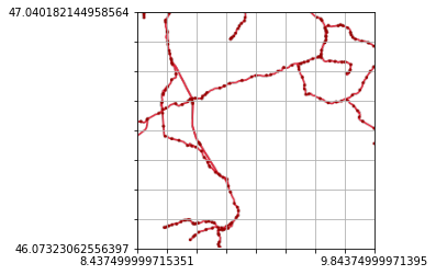
https://wmts.geo.admin.ch/1.0.0/ch.bav.schienennetz/default/current/3857/8/134/90.png -
TMS request URL:
"https://wmts.geo.admin.ch/1.0.0/ch.bav.schienennetz/default/current/3857/"+z1+"/"+x1+"/"+y1+".png" -
256*256 pixel snapshot:
-
Layer: ch.swisstopo.geologie-eiszeit-lgm
-
TileMatrixSet: 3857_18
-
TileMatrix: 8
-
Zoom correction:
z1 = z1; -
URL used for snapshot:
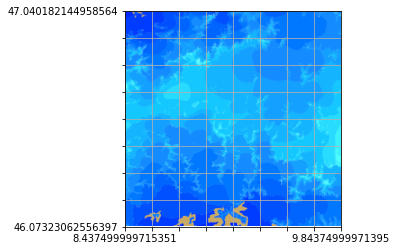
https://wmts.geo.admin.ch/1.0.0/ch.swisstopo.geologie-eiszeit-lgm/default/20110318/3857/8/134/90.png -
TMS request URL:
"https://wmts.geo.admin.ch/1.0.0/ch.swisstopo.geologie-eiszeit-lgm/default/20110318/3857/"+z1+"/"+x1+"/"+y1+".png" -
256*256 pixel snapshot:
-
Layer: ch.swisstopo.landeskarte-farbe-10
-
TileMatrixSet: 3857_19
-
TileMatrix: 8
-
Zoom correction:
z1 = z1; -
URL used for snapshot:
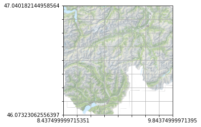
https://wmts.geo.admin.ch/1.0.0/ch.swisstopo.landeskarte-farbe-10/default/current/3857/8/134/90.png -
TMS request URL:
"https://wmts.geo.admin.ch/1.0.0/ch.swisstopo.landeskarte-farbe-10/default/current/3857/"+z1+"/"+x1+"/"+y1+".png" -
256*256 pixel snapshot:
-
Layer: ch.swisstopo.lubis-terrestrische_aufnahmen
-
TileMatrixSet: 3857_18
-
TileMatrix: 8
-
Zoom correction:
z1 = z1; -
URL used for snapshot:
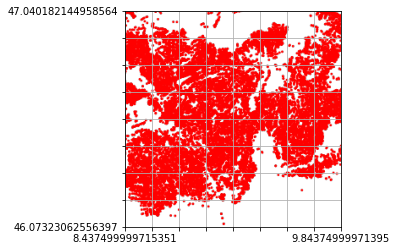
https://wmts.geo.admin.ch/1.0.0/ch.swisstopo.lubis-terrestrische_aufnahmen/default/9999/3857/8/134/90.png -
TMS request URL:
"https://wmts.geo.admin.ch/1.0.0/ch.swisstopo.lubis-terrestrische_aufnahmen/default/9999/3857/"+z1+"/"+x1+"/"+y1+".png" -
256*256 pixel snapshot:
-
Layer: ch.swisstopo.zeitreihen
-
TileMatrixSet: 3857_18
-
TileMatrix: 8
-
Zoom correction:
z1 = z1; -
URL used for snapshot:
https://wmts.geo.admin.ch/1.0.0/ch.swisstopo.zeitreihen/default/20181231/3857/8/134/90.png -
TMS request URL:
"https://wmts.geo.admin.ch/1.0.0/ch.swisstopo.zeitreihen/default/20181231/3857/"+z1+"/"+x1+"/"+y1+".png" -
256*256 pixel snapshot:

-
Layer: AIRS_L2_Cloud_Top_Height_Night
-
TileMatrixSet: GoogleMapsCompatible_Level6
-
TileMatrix: 0
-
Zoom correction:
z1 = z1; -
URL used for snapshot:
https://gibs.earthdata.nasa.gov/wmts/epsg3857/best/wmts.cgi?SERVICE=WMTS&REQUEST=GetTile&VERSION=1.0.0&LAYER=AIRS_L2_Cloud_Top_Height_Night&STYLE=default&TILEMATRIXSET=GoogleMapsCompatible_Level6&TIME=2002-08-30&TILEMATRIX=0&TILEROW=0&TILECOL=0&FORMAT=image/png -
TMS request URL:
"https://gibs.earthdata.nasa.gov/wmts/epsg3857/best/wmts.cgi?SERVICE=WMTS&REQUEST=GetTile&VERSION=1.0.0&LAYER=AIRS_L2_Cloud_Top_Height_Night&STYLE=default&TILEMATRIXSET=GoogleMapsCompatible_Level6&TIME=2002-08-30&TILEMATRIX="+z1+"&TILEROW="+y1+"&TILECOL="+x1+"&FORMAT=image/png" -
256*256 pixel snapshot:

-
Layer: AIRS_L2_Surface_Air_Temperature_Day
-
TileMatrixSet: GoogleMapsCompatible_Level6
-
TileMatrix: 0
-
Zoom correction:
z1 = z1; -
TMS request URL:
"https://gibs.earthdata.nasa.gov/wmts/epsg3857/best/wmts.cgi?SERVICE=WMTS&REQUEST=GetTile&VERSION=1.0.0&LAYER=AIRS_L2_Surface_Air_Temperature_Day&STYLE=default&TILEMATRIXSET=GoogleMapsCompatible_Level6&TIME=2003-01-30&TILEMATRIX="+z1+"&TILEROW="+y1+"&TILECOL="+x1+"&FORMAT=image/png" -
256*256 pixel snapshot:
-
Layer: brtachtergrondkaart
-
TileMatrixSet: EPSG:3857
-
TileMatrix: 08
-
Zoom correction:
if (z1 < 10) {z1 = "0" + z1}; -
URL used for snapshot:
https://geodata.nationaalgeoregister.nl/tiles/service/wmts?SERVICE=WMTS&REQUEST=GetTile&VERSION=1.0.0&LAYER=brtachtergrondkaart&STYLE=default&TILEMATRIXSET=EPSG:3857&TILEMATRIX=08&TILEROW=84&TILECOL=131&FORMAT=image/png -
TMS request URL:
"https://geodata.nationaalgeoregister.nl/tiles/service/wmts?SERVICE=WMTS&REQUEST=GetTile&VERSION=1.0.0&LAYER=brtachtergrondkaart&STYLE=default&TILEMATRIXSET=EPSG:3857&TILEMATRIX="+z1+"&TILEROW="+y1+"&TILECOL="+x1+"&FORMAT=image/png" -
256*256 pixel snapshot:
-
Layer: Toronto
-
TileMatrixSet: default028mm
-
TileMatrix: 13
-
Zoom correction:
z1 = z1; -
URL used for snapshot:
https://sampleserver6.arcgisonline.com/arcgis/rest/services/Toronto/ImageServer/WMTS/tile/1.0.0/Toronto/default/default028mm/13/2990/2289.png -
TMS request URL:
"https://sampleserver6.arcgisonline.com/arcgis/rest/services/Toronto/ImageServer/WMTS/tile/1.0.0/Toronto/default/default028mm/"+z1+"/"+y1+"/"+x1+".png" -
256*256 pixel snapshot:

-
Layer: MapaBaseTopograficov61_consombreado
-
TileMatrixSet: EPSG:900913
-
TileMatrix: EPSG:900913:0
-
Zoom correction:
z1 = "EPSG:900913:" + z1; -
URL used for snapshot:
http://gaiamapas2.inegi.org.mx/mdmCache/service/wmts?service=wmts&request=getTile&LAYER=MapaBaseTopograficov61_consombreado&STYLE=&TILEMATRIXSET=EPSG:900913&TILEMATRIX=EPSG:900913:0&TILEROW=0&TILECOL=0&FORMAT=image/jpeg -
TMS request URL:
"http://gaiamapas2.inegi.org.mx/mdmCache/service/wmts?service=wmts&request=getTile&LAYER=MapaBaseTopograficov61_consombreado&STYLE=&TILEMATRIXSET=EPSG:900913&TILEMATRIX="+z1+"&TILEROW="+y1+"&TILECOL="+x1+"&FORMAT=image/jpeg" -
256*256 pixel snapshot:
-
Layer: srtm
-
TileMatrixSet: WholeWorld_WebMercator
-
TileMatrix: 5
-
Zoom correction:
z1 = z1; -
URL used for snapshot:
https://ows.digitalearth.africa/wmts?SERVICE=WMTS&REQUEST=GetTile&VERSION=1.0.0&LAYER=srtm&FORMAT=image/png&STYLE=colours&TILEMATRIXSET=WholeWorld_WebMercator&TILEMATRIX=5&TILEROW=16&TILECOL=19 -
TMS request URL:
"https://ows.digitalearth.africa/wmts?SERVICE=WMTS&REQUEST=GetTile&VERSION=1.0.0&LAYER=srtm&FORMAT=image/png&STYLE=colours&TILEMATRIXSET=WholeWorld_WebMercator&TILEMATRIX="+z1+"&TILEROW="+y1+"&TILECOL="+x1 -
256*256 pixel snapshot:
-
Layer: Korea_Topo_Map
-
TileMatrixSet: default028mm
-
TileMatrix: 10
-
Zoom correction:
z1 = z1; -
URL used for snapshot:
https://services.esrikr.com/arcgis/rest/services/Korea_Topo_Map/MapServer/WMTS/tile/1.0.0/Korea_Topo_Map/default/default028mm/10/396/871.png -
TMS request URL:
"https://services.esrikr.com/arcgis/rest/services/Korea_Topo_Map/MapServer/WMTS/tile/1.0.0/Korea_Topo_Map/default/default028mm/"+z1+"/"+y1+"/"+x1+".png" -
256*256 pixel snapshot:
-
Layer: Basemaps_Topography
-
TileMatrixSet: default028mm
-
TileMatrix: 7
-
Zoom correction:
z1 = z1; -
URL used for snapshot:
https://gis.elsenburg.com/arcgis/rest/services/Basemaps/Topography/MapServer/WMTS/tile/1.0.0/Basemaps_Topography/default/default028mm/7/75/73.png -
TMS request URL:
"https://gis.elsenburg.com/arcgis/rest/services/Basemaps/Topography/MapServer/WMTS/tile/1.0.0/Basemaps_Topography/default/default028mm/"+z1+"/"+y1+"/"+x1+".png" -
256*256 pixel snapshot:
-
Layer: capabaseargenmap
-
TileMatrixSet: EPSG:3857
-
TileMatrix: EPSG:3857:5
-
Zoom correction:
z1 = "EPSG:3857:" + z1; -
URL used for snapshot:
https://wms.ign.gob.ar/geoserver/gwc/service/wmts/rest/capabaseargenmap/default/EPSG:3857/EPSG:3857:5/3/14?format=image/png -
TMS request URL:
"https://wms.ign.gob.ar/geoserver/gwc/service/wmts/rest/capabaseargenmap/default/EPSG:3857/"+z1+"/"+y1+"/"+x1+"?format=image/png" -
256*256 pixel snapshot:
-
Layer: Basemap_Imagery_2014
-
TileMatrixSet: default028mm
-
TileMatrix: 7
-
Zoom correction:
z1 = z1 - 9; -
URL used for snapshot:
https://maps.ottawa.ca/arcgis/rest/services/Basemap_Imagery_2014/MapServer/WMTS/tile/1.0.0/Basemap_Imagery_2014/default/default028mm/7/23461/18988.jpg -
TMS request URL:
"https://maps.ottawa.ca/arcgis/rest/services/Basemap_Imagery_2014/MapServer/WMTS/tile/1.0.0/Basemap_Imagery_2014/default/default028mm/"+z1+"/"+y1+"/"+x1+".jpg" -
256*256 pixel snapshot:

Prev (WMS Examples) | Home | Manual | Index | Top | (Elevation (DEM) data) Next