DocWMSExamples - Maproom/qmapshack GitHub Wiki
Prev (Maps) | Home | Manual | Index | (WMTS Examples) Next
Table of contents
The use of WMS services in QMS has been described in sections "Use WMS server as TMS server" and "How to build the URL when using WMS via TMS".
This page shows more examples of WMS services that can be used in QMS with the help of TMS files. At the same time, the examples demonstrate the wide range of data that can be obtained through WMS services (topo maps, ortho maps, geology, weather, environment, administrative data, tourist information, ...).
One purpose of the examples is to give sufficient information to compose the necessary TMS files for accessing WMS services with different versions and coordinate systems. Normally, other layers than the mentioned ones of the same service can be reached by simply replacing the layer name within the shown URL with a different one.
The examples should also help users to build TMS files for other WMS services.
Remarks:
- In the examples, preference is given to CRS EPSG:4326. Most WMS services may support EPSG:3857 as well.
- WMS services may fail for various reasons, among them: capabilities files out of spec or with data errors, access restrictions on the server, no global coordinate systems supported, etc.
Each example consists of the following information
-
QMS 1920*1080 px (lon/lat) BBox:
The data provided by the service sometimes appears only in a narrow zoom area. If you use in QMS an EPSG:4326 grid (geographic coordinates) in the map window and set the map window of QMS to the indicated pixel and bounding box size (e.g. as QMS fullscreen on a 1920*1080 pixel screen), then the indicated snapshot is approximately in the middle of the screen. In this resolution, the WMS data should be visible (change zoom slightly if data are not visible).
This bounding box gives at the same time information about the geographic region used in the WMS service (country, continent, ...).
-
Axes order:
Depending on the WMS version (1.3.0 or 1.1.x) and the coordinate system used in the layer (EPSG:4326 or CRS:84), different bounding box variants are needed for the TMS file. The given line can be inserted directly into the EPSG:4326/CRS:84 TMS template given below.
-
TMS request URL:
This URL is also to be inserted into the TMS template below. Choose the template for the coordinate system used in the
crs/srs=...parameter of the URL. -
256*256 pixel snapshot:
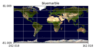
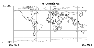
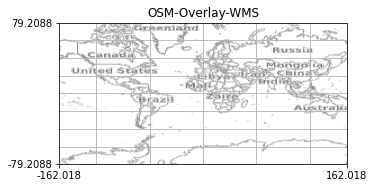
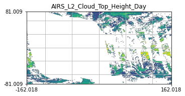
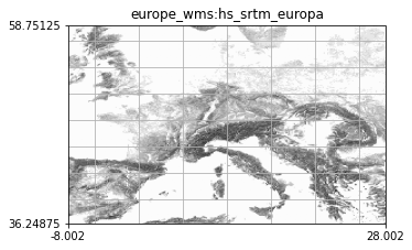
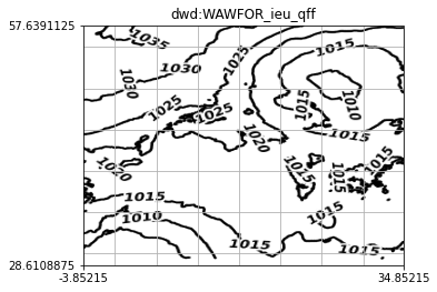
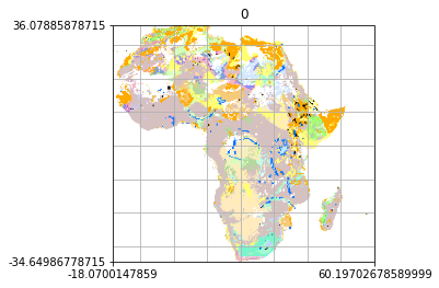
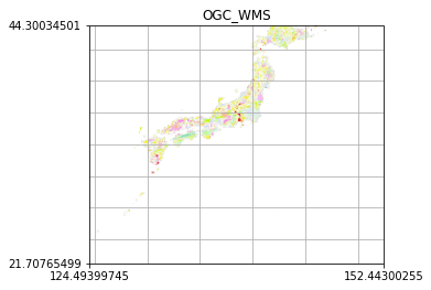
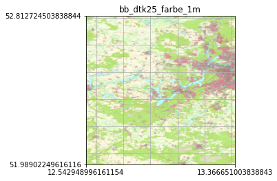
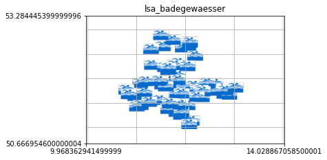
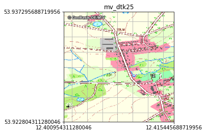
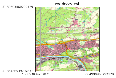
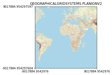
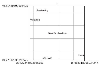
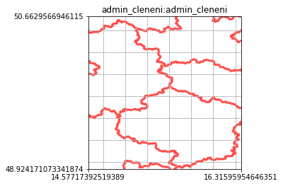
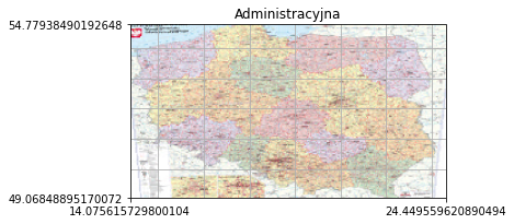
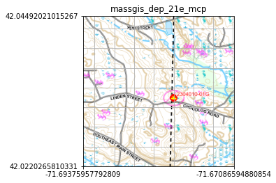
The shown snapshot was obtained directly by a request from the WMS server. No geographic projection was applied to the snapshot. Thus, some snapshots are distorted. It shows at the axes the coordinates (in the CRS of the request) of the selected area and as title the name of the used layer. The correct layout can be seen when using the service in QMS.
Please note that WMS services with a valid
time=<timestamp>parameter in the request URL deliver data that is time-dependent, i.e. the snapshots shown change over time. Removing in such a case thetime=<timestamp>parameter from the request URL delivers the latest data available on the server.
For reasons of space, details about the service and the layer content are not given. These can be obtained from the capabilities file belonging to the URL.
The structure of the bounding box, the coordinate system parameter name, and the coordinate axes part in the request URL depends on the version of the WMS service and the type of coordinate system:
- WMS version 1.1.x (found in
version=xxxpart of request URL):- Coordinate system parameter name:
srs(found insrs=xxxpart of request URL) - Coordinate axes order (found in
bbox =line of axes order information, lon: east/west, lat: north/south):- EPSG:4326: lon/lat
- CRS:84: lat/lon
- EPSG:3857: easting/northing
- Coordinate system parameter name:
- WMS version 1.3.0 (found in
version=xxxpart of request URL):- Coordinate system parameter name:
crs(found incrs=xxxpart of request URL) - Coordinate axes order (found in
bbox =line of axes order information):- EPSG:4326: lat/lon
- CRS:84: lon/lat
- EPSG:3857: easting/northing
- Coordinate system parameter name:
<TMS>
<Layer idx="0">
<Title>TMS for WMS example</Title>
<Script><![CDATA[(
function convert(z,x,y)
 {function tile2lon(x, z) {return x / Math.pow(2.0, z) * 360.0 -180.;}
  function tile2lat(y, z) {
    n = Math.PI - (2.0 * Math.PI * y) / Math.pow(2.0, z);
    return (Math.atan(Math.sinh(n)))*180.0/Math.PI;
  }
  north = tile2lat(y, z);
  south = tile2lat(y + 1, z);
  west = tile2lon(x, z);
  east = tile2lon(x + 1, z);
  <bbox>
  return <request_url>
}
)]]></Script>
</Layer>
<Copyright>see capabilities file belonging to URL</Copyright>
</TMS>
In this template replace
-
<bbox>with the expression shown in the "Axes order" line, -
<request_url>with the URL shown in the "TMS request URL" line of the example (without line breaks and included in quotes).
<TMS>
<Layer idx="0">
<Title>TMS for WMS example</Title>
<Script><![CDATA[(
function convert(z,x,y)
 { function M(n){return 256*n*(156543.03392804062/(1<<z))-20037508.342789244}
  y1=(1<<z)-1-y;
  bbox=M(x)+','+M(y1)+','+M(x+1)+','+M(y1+1);
  return <request_url>
}
)]]></Script>
</Layer>
<Copyright>see capabilities file belonging to URL</Copyright>
</TMS>
In this template replace <request_url> with the URL shown in the "TMS request URL" line of the example (without line breaks and included in quotes).
Remarks:
- The URL in the example using the French
wxs.ign.frserver has to be prepared especially: to get results you must have a username, a password, and an access key and insert them instead of the templates used in the URL. If there are non-ASCII characters in the username or password, then the username or password must be encoded using%xxescapes. - There are 2 examples for the Canadian Toporama server. This server supports only WMS version 1.1.1. One example is using EPSG:4326, the other one EPSG:3857.
-
QMS 1920*1080 px BBox: (-175.0, -85.0, 175.0, 85.0)
-
Axes order:
bbox = south + "," + west +"," + north + "," + east; -
TMS request URL:
"https://demo.mapserver.org/cgi-bin/wms?service=WMS&version=1.3.0&request=GetMap&layers=bluemarble&styles=&width=256&height=256&crs=EPSG:4326&bbox=" + bbox + "&format=image/png&transparent=TRUE&bgcolor=0xFFFFFF&exceptions=XML" -
256*256 px snapshot:
-
QMS 1920*1080 px BBox: (-175.0, -85.0, 175.0, 85.0)
-
Axes order:
bbox = south + "," + west +"," + north + "," + east; -
TMS request URL:
"https://geoservice.dlr.de/eoc/basemap/ows?SERVICE=WMS&service=WMS&version=1.3.0&request=GetMap&layers=ne_countries&styles=&width=256&height=256&crs=EPSG:4326&bbox=" + bbox + "&format=image/png&transparent=TRUE&bgcolor=0xFFFFFF&exceptions=XML" -
256*256 px snapshot:
-
QMS 1920*1080 px BBox: (-175.0, -85.0, 175.0, 85.0)
-
Axes order:
bbox = south + "," + west +"," + north + "," + east; -
TMS request URL:
"https://ows.mundialis.de/osm/service?service=WMS&version=1.3.0&request=GetMap&layers=OSM-Overlay-WMS&styles=default&width=256&height=256&crs=EPSG:4326&bbox=" + bbox + "&format=image/png&transparent=TRUE&bgcolor=0xFFFFFF&exceptions=XML" -
256*256 px snapshot:
-
QMS 1920*1080 px BBox: (-175.0, -85.0, 175.0, 85.0)
-
Axes order:
bbox = west + "," + south + "," + east +"," + north; -
TMS request URL:
"https://neo.sci.gsfc.nasa.gov/wms/wms?service=WMS&version=1.3.0&request=GetMap&layers=MODAL2_M_AER_RA&styles=rgb&width=256&height=256&crs=CRS:84&bbox=" + bbox + "&format=image/png&transparent=TRUE&bgcolor=0xFFFFFF&exceptions=XML&time=2016-09-01" -
256*256 px snapshot:

-
QMS 1920*1080 px BBox: (-175.0, -85.0, 175.0, 85.0)
-
Axes order:
bbox = south + "," + west +"," + north + "," + east; -
TMS request URL:
"https://gibs.earthdata.nasa.gov/wms/epsg3857/best/wms.cgi?service=WMS&version=1.3.0&request=GetMap&layers=AIRS_L2_Cloud_Top_Height_Day&styles=default&width=256&height=256&crs=EPSG:4326&bbox=" + bbox + "&format=image/png&transparent=TRUE&bgcolor=0xFFFFFF&exceptions=XML&time=2021-04-09" -
256*256 px snapshot:
-
QMS 1920*1080 px BBox: (-125.01499999999999, 0.033789062500005684, 145.015, 85.0)
-
Axes order:
bbox = south + "," + west +"," + north + "," + east; -
TMS request URL:
"http://maps.heigit.org/osm-wms/service?service=WMS&version=1.3.0&request=GetMap&layers=europe_wms:hs_srtm_europa&styles=&width=256&height=256&crs=EPSG:4326&bbox=" + bbox + "&format=image/png&transparent=TRUE&bgcolor=0xFFFFFF&exceptions=XML" -
256*256 px snapshot:
-
QMS 1920*1080 px BBox: (-129.64112500000002, -18.106412109375007, 160.64112500000002, 85.0)
-
Axes order:
bbox = south + "," + west +"," + north + "," + east; -
TMS request URL:
"https://maps.dwd.de/geoserver/ows?SERVICE=WMS&service=WMS&version=1.3.0&request=GetMap&layers=dwd:WAWFOR_ieu_qff&styles=wawfor_ieu_qff_pressure_isolines&width=256&height=256&crs=EPSG:4326&bbox=" + bbox + "&format=image/png&transparent=TRUE&bgcolor=0xFFFFFF&exceptions=XML&time=2021-04-15T12:00:00.000Z" -
256*256 px snapshot:
-
QMS 1920*1080 px BBox: (-175.0, -85.0, 175.0, 85.0)
-
Axes order:
bbox = south + "," + west +"," + north + "," + east; -
TMS request URL:
"https://certmapper.cr.usgs.gov:443/server/services/geology/africa/MapServer/WmsServer?service=WMS&version=1.3.0&request=GetMap&layers=0&styles=default&width=256&height=256&crs=EPSG:4326&bbox=" + bbox + "&format=image/png&transparent=TRUE&bgcolor=0xFFFFFF&exceptions=XML" -
256*256 px snapshot:
-
QMS 1920*1080 px BBox: (33.65973087500004, -14.652455510937493, 175.0, 80.66045551093751)
-
Axes order:
bbox = south + "," + west +"," + north + "," + east; -
TMS request URL:
"https://gbank.gsj.jp/ows/GSJ_Combined_Bedrock_and_Superficial_Geology_and_Age/wms?service=WMS&version=1.3.0&request=GetMap&layers=OGC_WMS&styles=&width=256&height=256&crs=EPSG:4326&bbox=" + bbox + "&format=image/png&transparent=TRUE&bgcolor=0xFFFFFF&exceptions=XML" -
256*256 px snapshot:
-
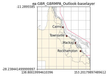
QMS 1920*1080 px BBox: (91.99500310252944, -55.51555007812499, 175.0, 15.987550078124993)
-
Axes order:
bbox = south + "," + west +"," + north + "," + east; -
TMS request URL:
"https://maps.eatlas.org.au/maps/ows?SERVICE=WMS&service=WMS&version=1.3.0&request=GetMap&layers=ea:GBR_GBRMPA_Outlook-baselayer&styles=&width=256&height=256&crs=EPSG:4326&bbox=" + bbox + "&format=image/png&transparent=TRUE&bgcolor=0xFFFFFF&exceptions=XML" -
256*256 px snapshot:
-
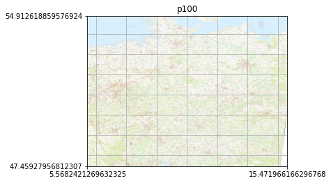
QMS 1920*1080 px BBox: (-26.618861000870762, 35.46406164593952, 47.65906929413076, 66.90783678176047)
-
Axes order:
bbox = south + "," + west +"," + north + "," + east; -
TMS request URL:
"https://sgx.geodatenzentrum.de/wms_topplus_open?service=WMS&version=1.3.0&request=GetMap&layers=p100&styles=inspire_common:DEFAULT&width=256&height=256&crs=EPSG:4326&bbox=" + bbox + "&format=image/png&transparent=TRUE&bgcolor=0xFFFFFF&exceptions=XML" -
256*256 px snapshot:
-
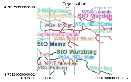
QMS 1920*1080 px BBox: (-12.515000000000002, 40.10178125000004, 32.51500000000001, 62.89821874999996)
-
Axes order:
bbox = west + "," + south + "," + east +"," + north; -
TMS request URL:
"https://atlas.wsv.bund.de/bwastr/wms?service=WMS&version=1.1.1&request=GetMap&layers=Organisation&styles=&width=256&height=256&srs=EPSG:4326&bbox=" + bbox + "&format=image/png&transparent=TRUE&bgcolor=0xFFFFFF&exceptions=application/vnd.ogc.se_xml" -
256*256 px snapshot:
-
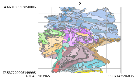
QMS 1920*1080 px BBox: (-23.206568452625003, 36.06882435407029, 44.342833452625, 66.1315566459297)
-
Axes order:
bbox = south + "," + west +"," + north + "," + east; -
TMS request URL:
"https://services.bgr.de/wms/grundwasser/hyraum/?service=WMS&version=1.3.0&request=GetMap&layers=2&styles=default&width=256&height=256&crs=EPSG:4326&bbox=" + bbox + "&format=image/png&transparent=TRUE&bgcolor=0xFFFFFF&exceptions=XML" -
256*256 px snapshot:
-
QMS 1920*1080 px BBox: (-48.39943027751785, 30.940274836651607, 68.60232930843344, 70.96799624092837)
-
Axes order:
bbox = south + "," + west +"," + north + "," + east; -
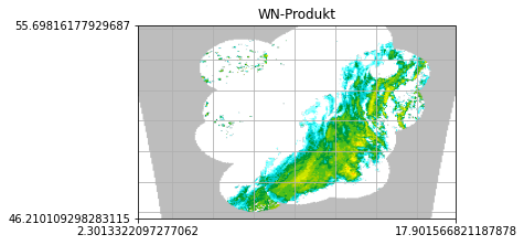
TMS request URL:
"https://maps.dwd.de/geoserver/dwd/WN-Produkt/ows?SERVICE=WMS&service=WMS&version=1.3.0&request=GetMap&layers=WN-Produkt&styles=wn-produkt&width=256&height=256&crs=EPSG:4326&bbox=" + bbox + "&format=image/png&transparent=TRUE&bgcolor=0xFFFFFF&exceptions=XML&time=2021-04-12T08:25:00.000Z" -
256*256 px snapshot:
-
QMS 1920*1080 px BBox: (-23.575691033137588, 35.913705202269036, 44.71476872931645, 66.28532424687441)
-
Axes order:
bbox = south + "," + west +"," + north + "," + east; -
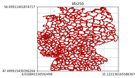
TMS request URL:
"https://sgx.geodatenzentrum.de/wms_kfz250?SERVICE=WMS&service=WMS&version=1.3.0&request=GetMap&layers=kfz250&styles=kfz:default&width=256&height=256&crs=EPSG:4326&bbox=" + bbox + "&format=image/png&transparent=TRUE&bgcolor=0xFFFFFF&exceptions=XML" -
256*256 px snapshot:
-
QMS 1920*1080 px BBox: (-32.26145284162501, 32.50902151188281, 53.728999841625004, 69.29828548811719)
-
Axes order:
bbox = south + "," + west +"," + north + "," + east; -
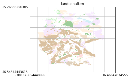
TMS request URL:
"https://sgx.geodatenzentrum.de/wms_landschaften?service=WMS&version=1.3.0&request=GetMap&layers=landschaften&styles=inspire_common:DEFAULT&width=256&height=256&crs=EPSG:4326&bbox=" + bbox + "&format=image/png&transparent=TRUE&bgcolor=0xFFFFFF&exceptions=XML" -
256*256 px snapshot:
-
QMS 1920*1080 px BBox: (2.3060205142500045, 47.95426999373436, 24.569737485749993, 53.91726400626564)
-
Axes order:
bbox = south + "," + west +"," + north + "," + east; -
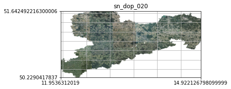
TMS request URL:
"https://geodienste.sachsen.de/wms_geosn_dop-rgb/guest?service=WMS&version=1.3.0&request=GetMap&layers=sn_dop_020&styles=default&width=256&height=256&crs=EPSG:4326&bbox=" + bbox + "&format=image/png&transparent=TRUE&bgcolor=0xFFFFFF&exceptions=XML" -
256*256 px snapshot:
-
QMS 1920*1080 px BBox: (9.865917471208666, 50.66337707755489, 16.04368252879133, 54.138369922445115)
-
Axes order:
bbox = south + "," + west +"," + north + "," + east; -
TMS request URL:
"https://isk.geobasis-bb.de/ows/dtk25farbe_wms?service=WMS&version=1.3.0&request=GetMap&layers=bb_dtk25_farbe_1m&styles=default&width=256&height=256&crs=EPSG:4326&bbox=" + bbox + "&format=image/png&transparent=TRUE&bgcolor=0xFFFFFF&exceptions=XML" -
256*256 px snapshot:
-
QMS 1920*1080 px BBox: (-3.2282754387500088, 46.45443034375002, 27.225505438750012, 57.49696965624999)
-
Axes order:
bbox = south + "," + west +"," + north + "," + east; -
TMS request URL:
"https://www.geodatenportal.sachsen-anhalt.de/gfds/ws/wms/LSA_Badegewaesser/ows.wms?language=ger&service=WMS&version=1.3.0&request=GetMap&layers=lsa_badegewaesser&styles=default&width=256&height=256&crs=EPSG:4326&bbox=" + bbox + "&format=image/png&transparent=TRUE&bgcolor=0xFFFFFF&exceptions=XML" -
256*256 px snapshot:
-
QMS 1920*1080 px BBox: (12.353857334600338, 53.899482250712694, 12.462542665399663, 53.96061774928731)
-
Axes order:
bbox = south + "," + west +"," + north + "," + east; -
TMS request URL:
"https://www.geodaten-mv.de/dienste/adv_dtk25?language=ger&service=WMS&version=1.3.0&request=GetMap&layers=mv_dtk25&styles=default&width=256&height=256&crs=EPSG:4326&bbox=" + bbox + "&format=image/png&transparent=TRUE&bgcolor=0xFFFFFF&exceptions=XML" -
256*256 px snapshot:
-
QMS 1920*1080 px BBox: (7.465255478090324, 51.2846071439258, 7.791274521909676, 51.467992856074204)
-
Axes order:
bbox = south + "," + west +"," + north + "," + east; -
TMS request URL:
"https://www.wms.nrw.de/geobasis/wms_nw_dtk25?service=WMS&version=1.3.0&request=GetMap&layers=nw_dtk25_col&styles=default&width=256&height=256&crs=EPSG:4326&bbox=" + bbox + "&format=image/png&transparent=TRUE&bgcolor=0xFFFFFF&exceptions=XML" -
256*256 px snapshot:
-
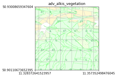
QMS 1920*1080 px BBox: (11.234188106429674, 50.854467279241675, 11.451537033570329, 50.976726050758316)
-
Axes order:
bbox = south + "," + west +"," + north + "," + east; -
TMS request URL:
"http://www.geoproxy.geoportal-th.de/geoproxy/services/adv_alkis_wms_th?service=WMS&version=1.3.0&request=GetMap&layers=adv_alkis_vegetation&styles=default&width=256&height=256&crs=EPSG:4326&bbox=" + bbox + "&format=image/png&transparent=TRUE&bgcolor=0xFFFFFF&exceptions=XML" -
256*256 px snapshot:
-
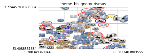
QMS 1920*1080 px BBox: (7.519828580333748, 52.9009282010625, 12.570261169666253, 54.23238199893751)
-
Axes order:
bbox = south + "," + west +"," + north + "," + east; -
TMS request URL:
"https://geodienste.hamburg.de/HH_WMS_Geotourismus?service=WMS&version=1.3.0&request=GetMap&layers=theme_hh_geotourismus&styles=&width=256&height=256&crs=EPSG:4326&bbox=" + bbox + "&format=image/png&transparent=TRUE&bgcolor=0xFFFFFF&exceptions=XML" -
256*256 px snapshot:
-
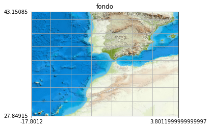
QMS 1920*1080 px BBox: (-88.00900000000001, 3.2229765625000084, 74.00900000000001, 67.77702343749999)
-
Axes order:
bbox = south + "," + west +"," + north + "," + east; -
TMS request URL:
"http://www.ign.es/wms-inspire/mapa-raster?SERVICE=WMS&service=WMS&version=1.3.0&request=GetMap&layers=fondo&styles=default&width=256&height=256&crs=EPSG:4326&bbox=" + bbox + "&format=image/png&transparent=TRUE&bgcolor=0xFFFFFF&exceptions=XML" -
256*256 px snapshot:
-
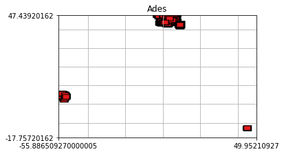
QMS 1920*1080 px BBox: (-175.0, -85.0, 175.0, 85.0)
-
Axes order:
bbox = south + "," + west +"," + north + "," + east; -
TMS request URL:
"http://mapsref.brgm.fr/WMS/mapserv?map=/carto/wxs/ades/public.map&service=WMS&version=1.3.0&request=GetMap&layers=Ades&styles=&width=256&height=256&crs=EPSG:4326&bbox=" + bbox + "&format=image/png&transparent=TRUE&bgcolor=0xFFFFFF&exceptions=XML" -
256*256 px snapshot:
-
QMS 1920*1080 px BBox: (-175.0, -85.0, 175.0, 85.0)
-
TMS request URL:
"https://<username>:<password>@wxs.ign.fr/<access_key>/geoportail/r/wms?service=WMS&version=1.3.0&request=GetMap&layers=GEOGRAPHICALGRIDSYSTEMS.PLANIGNV2&styles=normal&width=256&height=256&crs=EPSG:3857&bbox=" + bbox + "&format=image/png&transparent=TRUE&bgcolor=0xFFFFFF&exceptions=XML" -
256*256 px snapshot:
-
QMS 1920*1080 px BBox: (15.293746704743143, 49.70762170891801, 15.601815295256856, 49.88091029108199)
-
Axes order:
bbox = south + "," + west +"," + north + "," + east; -
TMS request URL:
"http://ags.cuzk.cz/arcgis/services/SpravniHranice/MapServer/WmsServer?service=WMS&version=1.3.0&request=GetMap&layers=5&styles=default&width=256&height=256&crs=EPSG:4326&bbox=" + bbox + "&format=image/png&transparent=TRUE&bgcolor=0xFFFFFF&exceptions=XML" -
256*256 px snapshot:
-
QMS 1920*1080 px BBox: (8.926120656067623, 46.12581296411107, 21.967012815589776, 53.461314803842306)
-
Axes order:
bbox = south + "," + west +"," + north + "," + east; -
TMS request URL:
"http://www.edpp.cz:8080/geoserver/ows?SERVICE=WMS&service=WMS&version=1.3.0&request=GetMap&layers=admin_cleneni:admin_cleneni&styles=admin_cleneni&width=256&height=256&crs=EPSG:4326&bbox=" + bbox + "&format=image/png&transparent=TRUE&bgcolor=0xFFFFFF&exceptions=XML" -
256*256 px snapshot:
-
QMS 1920*1080 px BBox: (-19.639701916243663, 39.877515781806146, 58.164877266934255, 63.970358071821046)
-
Axes order:
bbox = south + "," + west +"," + north + "," + east; -
TMS request URL:
"http://mapy.geoportal.gov.pl/wss/service/img/guest/Administracyjna/MapServer/WMSServer?service=WMS&version=1.3.0&request=GetMap&layers=Administracyjna&styles=default&width=256&height=256&crs=EPSG:4326&bbox=" + bbox + "&format=image/png&transparent=TRUE&bgcolor=0xFFFFFF&exceptions=XML" -
256*256 px snapshot:
-
QMS 1920*1080 px BBox: (14.96768232904782, 46.13399687289458, 14.992972682425899, 46.14038671966248)
-
Axes order:
bbox = south + "," + west +"," + north + "," + east; -
TMS request URL:
"https://storitve.eprostor.gov.si/ows-ins-wms/ows?SERVICE=WMS&service=WMS&version=1.3.0&request=GetMap&layers=cp:CP.CadastralParcel&styles=inspire_common:DEFAULT&width=256&height=256&crs=EPSG:4326&bbox=" + bbox + "&format=image/png&transparent=TRUE&bgcolor=0xFFFFFF&exceptions=XML" -
256*256 px snapshot:

-
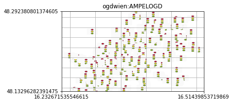
QMS 1920*1080 px BBox: (15.317058780177366, 47.8763995164403, 17.430011292567936, 48.54894410884906)
-
Axes order:
bbox = west + "," + south + "," + east +"," + north; -
TMS request URL:
"http://data.wien.gv.at/daten/geo?service=WMS&version=1.3.0&request=GetMap&layers=ogdwien:AMPELOGD&styles=AMPELOGD&width=256&height=256&crs=CRS:84&bbox=" + bbox + "&format=image/png&transparent=TRUE&bgcolor=0xFFFFFF&exceptions=XML" -
256*256 px snapshot:
-
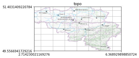
QMS 1920*1080 px BBox: (-9.16354458129543, 46.585068935997384, 18.24670450131543, 54.37476615900262)
-
Axes order:
bbox = south + "," + west +"," + north + "," + east; -
TMS request URL:
"https://cartoweb.wms.ngi.be/service?service=WMS&version=1.3.0&request=GetMap&layers=topo&styles=&width=256&height=256&crs=EPSG:4326&bbox=" + bbox + "&format=image/png&transparent=TRUE&bgcolor=0xFFFFFF&exceptions=XML" -
256*256 px snapshot:
-
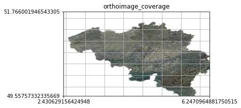
QMS 1920*1080 px BBox: (-9.97288967176289, 46.00338350791574, 18.650615316362888, 55.32019176198426)
-
Axes order:
bbox = south + "," + west +"," + north + "," + east; -
TMS request URL:
"http://wms.ngi.be/inspire/ortho/service?service=WMS&version=1.3.0&request=GetMap&layers=orthoimage_coverage&styles=inspire_common:DEFAULT&width=256&height=256&crs=EPSG:4326&bbox=" + bbox + "&format=image/png&transparent=TRUE&bgcolor=0xFFFFFF&exceptions=XML" -
256*256 px snapshot:
-
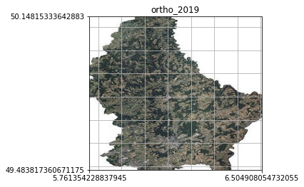
QMS 1920*1080 px BBox: (3.3448042946820884, 48.414651649686206, 8.921457988887912, 51.217319047413795)
-
Axes order:
bbox = south + "," + west +"," + north + "," + east; -
TMS request URL:
"http://wmts1.geoportail.lu/opendata/service?service=WMS&version=1.3.0&request=GetMap&layers=ortho_2019&styles=&width=256&height=256&crs=EPSG:4326&bbox=" + bbox + "&format=image/png&transparent=TRUE&bgcolor=0xFFFFFF&exceptions=XML" -
256*256 px snapshot:
-
QMS 1920*1080 px BBox: (3.9082796749074706, 44.834710537906126, 18.90700699412735, 48.490396498566774)
-
Axes order:
bbox = west + "," + south + "," + east +"," + north; -
TMS request URL:
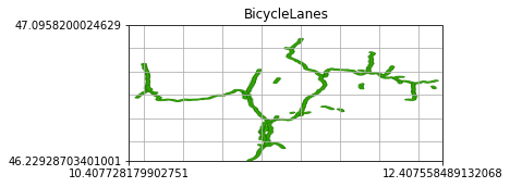
"https://geoservices.buergernetz.bz.it/geoserver/p_bz-transport_network/ows?SERVICE=WMS&service=WMS&version=1.3.0&request=GetMap&layers=BicycleLanes&styles=BicycleLanes&width=256&height=256&crs=CRS:84&bbox=" + bbox + "&format=image/png&transparent=TRUE&bgcolor=0xFFFFFF&exceptions=XML" -
256*256 px snapshot:
-
QMS 1920*1080 px BBox: (-25.681158168312454, 36.11653002246996, 60.85089104452706, 85.0)
-
Axes order:
bbox = south + "," + west +"," + north + "," + east; -
TMS request URL:
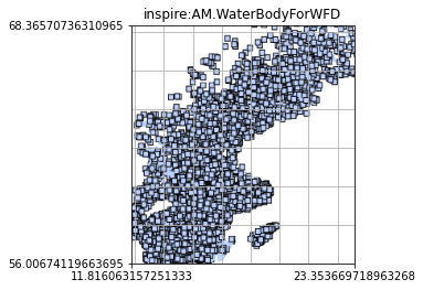
"http://maps3.sgu.se/geoserver/ows?SERVICE=WMS&service=WMS&version=1.3.0&request=GetMap&layers=inspire:AM.WaterBodyForWFD&styles=AM.WaterBodyForWFD&width=256&height=256&crs=EPSG:4326&bbox=" + bbox + "&format=image/png&transparent=TRUE&bgcolor=0xFFFFFF&exceptions=XML" -
256*256 px snapshot:
-
QMS 1920*1080 px BBox: (-75.48583778, 38.701156255468746, 111.33495778, 85.0)
-
Axes order:
bbox = south + "," + west +"," + north + "," + east; -
TMS request URL:
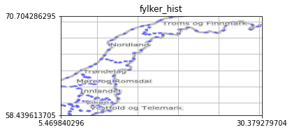
"https://wms.geonorge.no/skwms1/wms.adm_enheter2?service=WMS&version=1.3.0&request=GetMap&layers=fylker_hist&styles=default&width=256&height=256&crs=EPSG:4326&bbox=" + bbox + "&format=image/png&transparent=TRUE&bgcolor=0xFFFFFF&exceptions=XML" -
256*256 px snapshot:
-
QMS 1920*1080 px BBox: (-175.0, -43.48493152935937, 175.0, 85.0)
-
Axes order:
bbox = south + "," + west +"," + north + "," + east; -
TMS request URL:
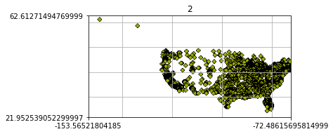
"http://sampleserver1b.arcgisonline.com/ArcGIS/services/Specialty/ESRI_StatesCitiesRivers_USA/MapServer/WMSServer?service=WMS&version=1.3.0&request=GetMap&layers=2&styles=default&width=256&height=256&crs=EPSG:4326&bbox=" + bbox + "&format=image/png&transparent=TRUE&bgcolor=0xFFFFFF&exceptions=XML" -
256*256 px snapshot:
-
QMS 1920*1080 px BBox: (-71.76816387256663, 41.985182146668805, -71.59646165417, 42.081764644516966)
-
Axes order:
bbox = west + "," + south + "," + east +"," + north; -
TMS request URL:
"http://giswebservices.massgis.state.ma.us/geoserver/ows?SERVICE=WMS&service=WMS&version=1.3.0&request=GetMap&layers=massgis_dep_21e_mcp&styles=&width=256&height=256&crs=CRS:84&bbox=" + bbox + "&format=image/png&transparent=TRUE&bgcolor=0xFFFFFF&exceptions=XML" -
256*256 px snapshot:
-
QMS 1920*1080 px BBox: (-175.0, -6.2430399836526504, 175.0, 79.48638814054466)
-
Axes order:
bbox = west + "," + south + "," + east +"," + north; -
TMS request URL:
"http://maps.geogratis.gc.ca/wms/toporama_en?service=WMS&version=1.1.1&request=GetMap&layers=WMS-Toporama&styles=&width=256&height=256&srs=EPSG:4326&bbox=" + bbox + "&format=image/jpeg&transparent=TRUE&bgcolor=0xFFFFFF&exceptions=application/vnd.ogc.se_xml" -
256*256 px snapshot:

-
QMS 1920*1080 px BBox: (-39.46439050450712, -85.0, 113.02470250637626, 85.0)
-
TMS request URL:
"http://maps.geogratis.gc.ca/wms/toporama_en?service=WMS&version=1.1.1&request=GetMap&layers=WMS-Toporama&styles=&width=256&height=256&srs=EPSG:3857&bbox=" + bbox + "&format=image/jpeg&transparent=TRUE&bgcolor=0xFFFFFF&exceptions=application/vnd.ogc.se_xml" -
256*256 px snapshot:

Prev (Maps) | Home | Manual | Index | Top | (WMTS Examples) Next