DocWorkingWithProjects - Maproom/qmapshack GitHub Wiki
Prev (Sources of QMapShack-compatible maps and elevation data) | Home | Manual | Index | (Handle GPX and QMS files) Next
Table of contents
Working with Projects
A project is a container that contains GIS items like waypoints, tracks, etc. There are several sources for projects. A single GPX file is a project. Or a query on a GIS server like Google.
You can create a new project, start a search or close all projects by the Workspace menu:
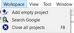
You get the same menu with a right-click when no item in the data view's workspace list is selected.
Prev (Sources of QMapShack-compatible maps and elevation data) | Home | Manual | Index | Top | (Handle GPX and QMS files) Next