| Visible Light |
Red-Green-Blue |
The true color or ‘RGB’ composite uses visible light bands red, green and blue in a combination, resulting in a naturally colored image. This composite represents a good representation of the Earth as humans would see it naturally. |
|
| Agriculture |
SWIR-NIR-Blue |
The agriculture band combination uses SWIR-1 (B11), near-infrared (B8), and blue (B2). It’s mostly used to monitor the health of crops because of how it uses short-wave and near-infrared. Both these bands are particularly good at highlighting dense vegetation that appears as dark green. |
|
| Plant Health |
Normalized Difference Vegetation Index (NDVI) |
The Normalized Difference Vegetation Index (NDVI) is used to separate states of vegetation health. As greater chlorophyll content (greater NDVI value) leads to increased reflection of near-infrared (NIR) and green wavelengths, the NDVI can monitor important parameters such as water stress in plants. %7D%7B(NIR+Red)%7D) |
|
| Burnt Areas |
Normalized Burn Ratio (NBR) |
The NBR is used to identify burned areas and provide a measure of burn severity. It is calculated as a ratio between the NIR and SWIR values. 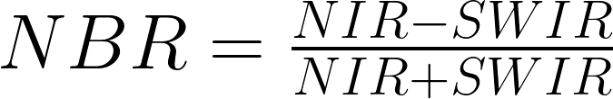 |
USGS |
| Vegetation Moisture |
Normalized Difference Moisture Index (NDMI) |
The NDMI is sensitive to moisture levels in vegetation. It is used to monitor droughts as well as monitor fuel levels in fire-prone areas. It uses NIR and SWIR bands to create a ratio designed to mitigate illumination and atmospheric effects.  |
|
| Bare Soil Adjusted Vegetation |
Modified Soil-Adjusted Vegetation Index (MSAVI) |
The MSAVI is an index designed to provide accurate data due to low vegetation or a lack of chlorophyll in the plants. It reduces the effect of the soil on the calculation of vegetation density in the field. %5E%7B2%7D-8*(NIR-Red)%7D%7B2%7D%7D) |
EOS Data Analytics |
| Bare Soil |
Bare soil index (BSI) |
The BSI shows all vegetation in green and barren ground in red colors. Water appears black. This index helps to discriminate the status of crops (growing, not yet growing), detect recent deforestation and monitor droughts. It can also be used to detect landslides or determine the extent of erosion in non-vegetated areas. -(NIR+Blue)%7D%7B(Red+SWIR1)+(NIR+Blue)%7D) |
Sentinel-Hub by Sinergise |