SAGTA Map Downloader Specifications - kartoza/SAGTA GitHub Wiki
The SAGTA Map downloader web UI and LizMap/QGIS map layouts produced by printing must meet these specifications
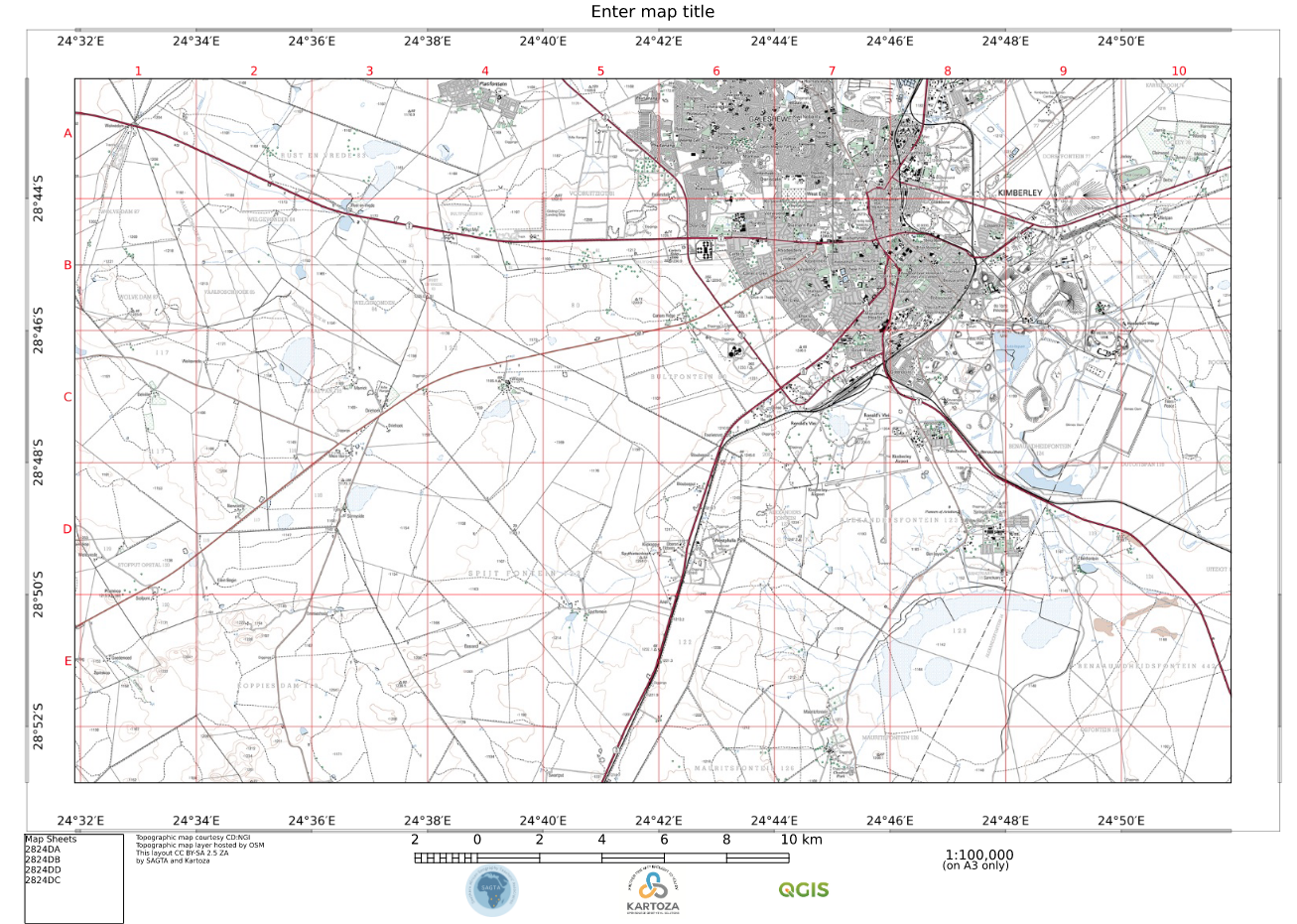
Standard template for all maps
- NGI graticule (no grid)
- Attribution
- MD (Pro only, not in Lite)
- North arrow
- Logos
- Title
- Legend
- List of map sheets this intersects with
Lite
Auth: no
Print map: Topo
Print map EXCLUDES: magnetic declination
Web functionality: All EXCEPT measure, draw (redlining) and elevation profile
This shows the correct initial Lite web view (with overlays and base layers expanded). Note available layers and functions:
This shows the correct template and content for Lite Topo map, except for graticule labels missing on the RH side :
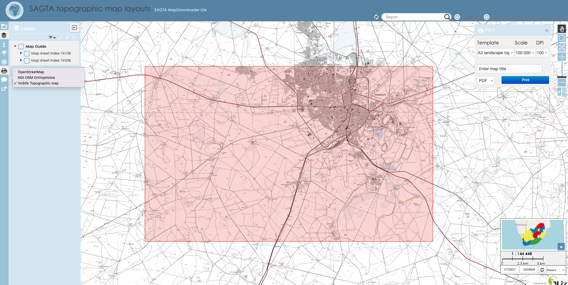
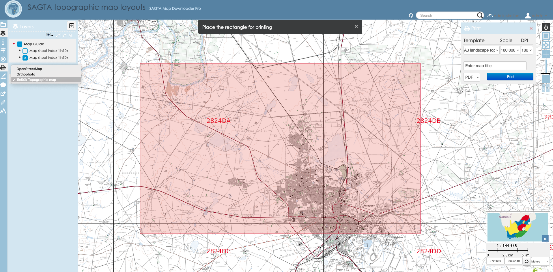
Pro
Auth: yes (SAGTA members only)
Print maps: all
Web functionality: all
This shows the correct initial Pro web view (with overlays and base layers expanded). Note available layers and functions. The only visible difference between Pro and Lite is that Pro has more tools in the LH toolbar:
Print Maps (pdfs from QGIS Layouts)
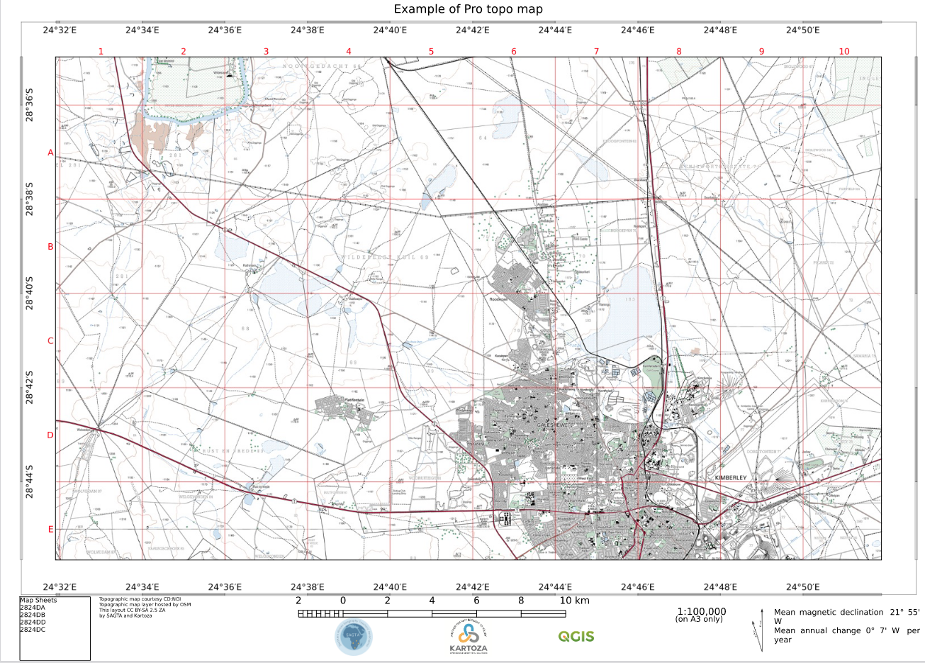
Topo
Map layers:
- 1:50k topo (from OSM or NGI servers)
Available scales:
- 1:10000 (not while OSM NGI topo is in use, it does not render at this scale)
- 1:25000
- 1:50000
- 1:100000
Template for topo
- standard template
- Index grid
Note MD in here, which is not in Lite:
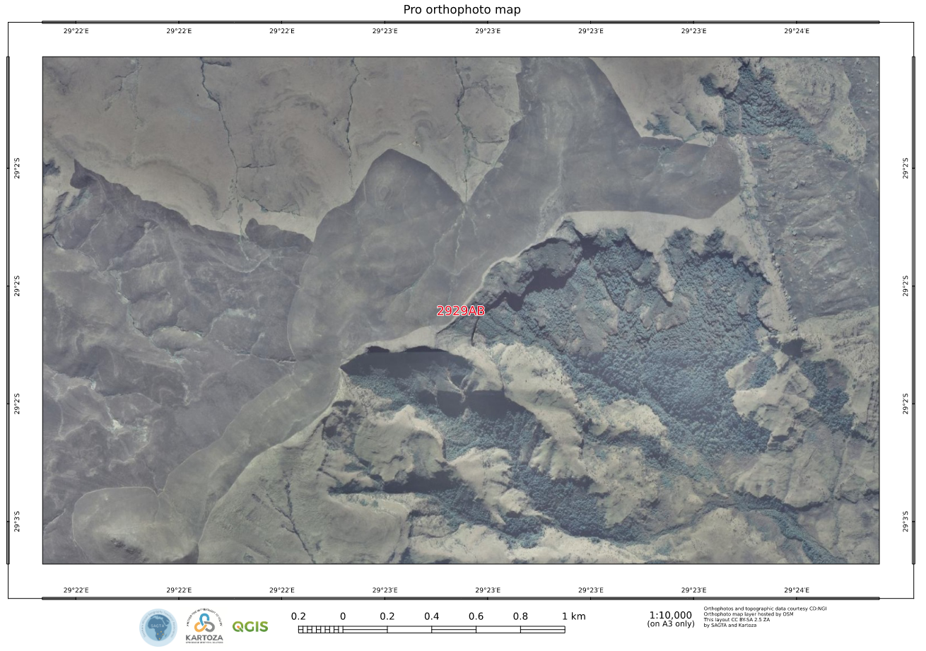
Ortho
Map layers:
- NGI aerial (OSM servers)
- 5m contours from Kartoza GeoServer where available: 1:10000 and larger scales must draw 5m (NOT filtered for 10m) AND 20m contour layers. 5m must draw over 20m.
- The 20m layer is just there for areas where there is no 5m data and for scales smaller than 1:10000. If you can set up rules to NOT draw 20m contours where there is 5m data then do so.
- Spot heights and trig beacons
Available scales:
- 1:5000
- 1:10000
- 1:25000
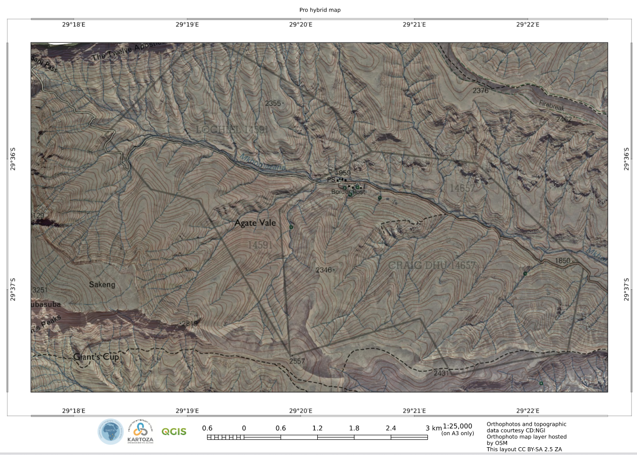
note ERRORS: no contours (even though 20m contours drew in web map). No trig beacons or spots heights. Graticule has a different style to Topo (use a template file!).
Hybrid
Map layers:
- 1:50k topo (with ‘multiply’ blending)
- NGI aerial
Available scales:
- 1:10000 (not while OSM NGI topo is in use, it does not render at this scale)
- 1:25000
- 1:50000