GeoOperations - jejjohnson/ml4eo GitHub Wiki
Core Operations
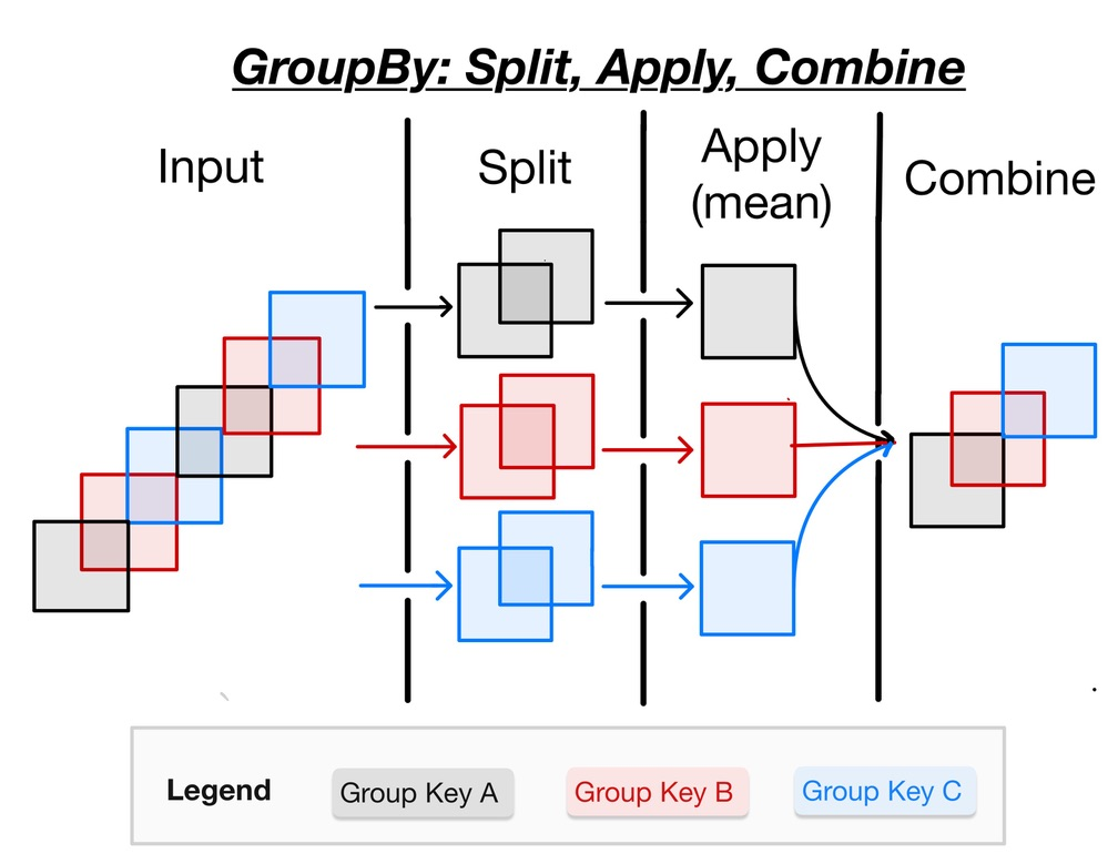
- Input
- Split
- Apply
- Combine
- Functions - Unary Binary, etc
- Grouped Computations
- Windowed Computations
Window Operations
- Coarsen - block windows of fixed length
- Rolling - Sliding windows of fixed length
Group Operations
- GroupBy
- Resample
Agnostic Operations
- Apply uFunc
Recipes
- Interpolation
- Climatology
- Anomalies
- Regridding
- Fill-NANs
- Calculating Exceedences
- Discretization
This will be useful for selecting the min/max values of a time series possibly over a given threshold.
- xarray - StackOverFlow
- xarray-docs
- xcdat time averages - Notebook
This will be useful for selecting the min/max values of a spatial field possibly over a given threshold.
- xarray-docs
- xcdat for geospatial weighted averaging - Notebook
- climatology with coarsen - Notebook
This is useful for capturing events with memory.
- Calculating heatwaves with rolling - gist
This will be a string of operations but we essentially want a workflow to count the number of occurrences given a specific threshold.
- count occurrences over threshold - xarray-stackoverflow
- climate event detection - Notebook
- regions and zonal statistics - Notebook
- Calculating Seasonality with selectors and masks - Notebook
- Removing Climatology with mapping - Notebook
- Calculating ENSO with xarray - Pythia
- Simple Example with Hostorical Period - Notebook
- Simple Climatology - Notebook
- xcdat for climatologies - Notebook
- Extended Tutorial - CDS Docs
- Example of different means (daily, monthly, seasonly, yearly) - geocat docs
- code with climatology and anomaly abstraction - Geocat
- Calculating Anomalies with Climatology and Weighted Means - Notebook
- xcdat for anomalies - Notebook
- Extended Tutorial - CDS Website
- Calculating Climatology & Anomalies with Dask - Gist
- Rainfall Anomalies and Climatology with Dask - Notebook
Synonyms - Regrid, Resample, Reproject
In general, we often need to interpolate data because of various reasons. For example, we may have some messy unstructured data structure which are basically point clouds with arbitrary and we want to move them to a structured data structure.
Resampling - Moving data to a higher or lower resolution
Regridding - Moving data from one grid resolution/composition to different one
Guides
Packages
- xcdat for horizontal regridding - Notebook
- xcdat for vertical regridding - Notebook
- Comparison of Interpolation Methods - xarray, pyinterp, xegrid, scipy - Notebook
- Simple example with rioxarray &
xarray- blog - Example with GOES and rioxarray - stackoverflow
- Pyresample Tutorial - ipynb
- Example with
GOES,pyproj,pyresample,cartopy- ipynb
