Examples - alabarga/geospatial-python GitHub Wiki
Monitoring Air Pollution From Space and the Ground
The COVID-19 pandemic has grounded flights, shut down industrial activities, and slashed greenhouse gas emissions and air pollution around the world. The fight against the virus has slowed down many economies at a huge cost, while air quality has improved dramatically during the pandemic. More
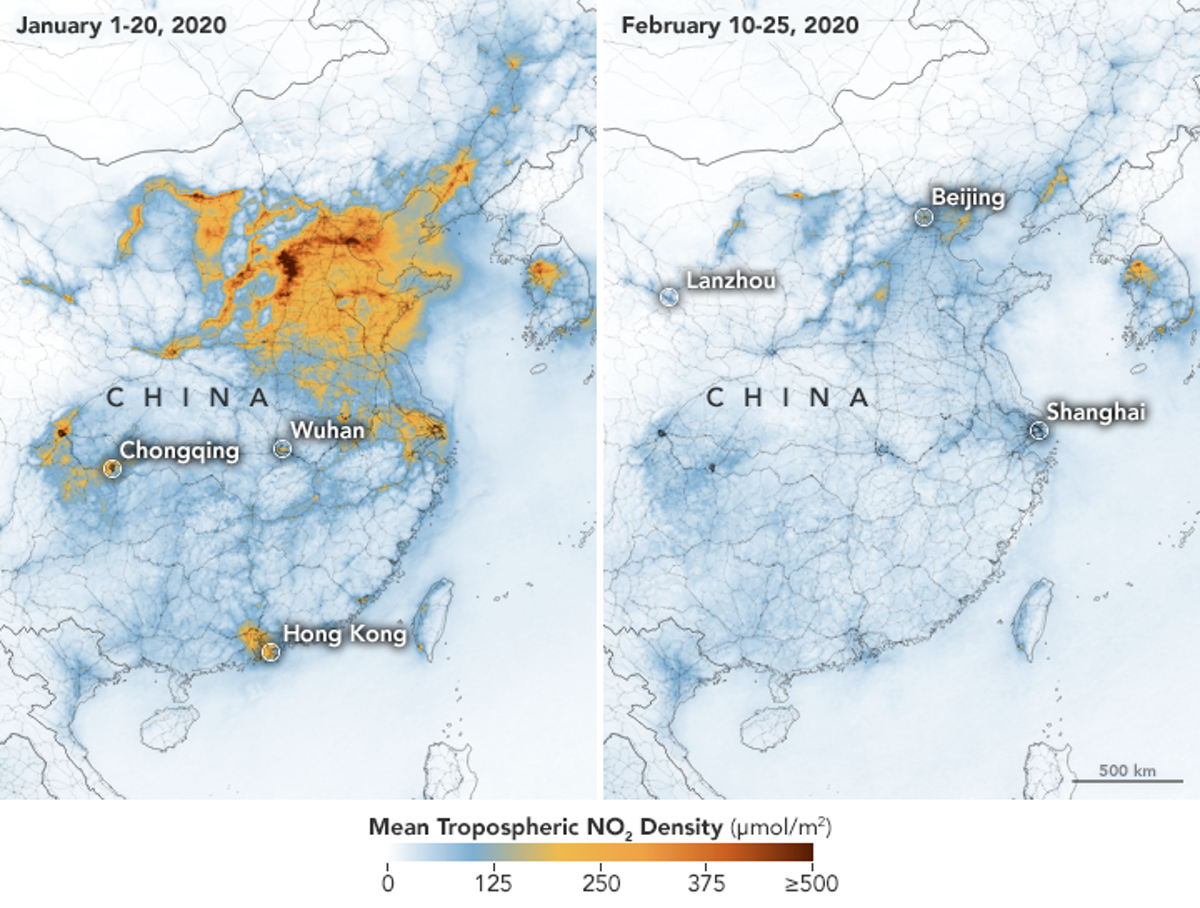 _ Air pollution plummeted in China as new daily cases of COVID-19 reached their peak. (ESA/NASA)_
Can We Detect Deforestation from Space?
Illegal gold mining activity has risen sharply over the last five years in Brazil’s indigenous Yanomami reservation in the heart of the Amazonian rainforest, a Reuters review of exclusive data shows. The Yanomami are the largest of South America’s tribes that remain relatively isolated from the outside world. More than 26,700 people live within the reservation, which is the size of Portugal.
Reuters worked with Earthrise Media, a non-profit group that analyzes satellite imagery, to plot the expansion of the mines across the Yanomami reservation. An analysis of these sites revealed that the number of mines has grown 20-fold over the past five years. Collectively, the mining areas identified in the reservation cover an area roughly the size of over 1,000 soccer fields. Read more


Fitness app Strava lights up staff at military bases
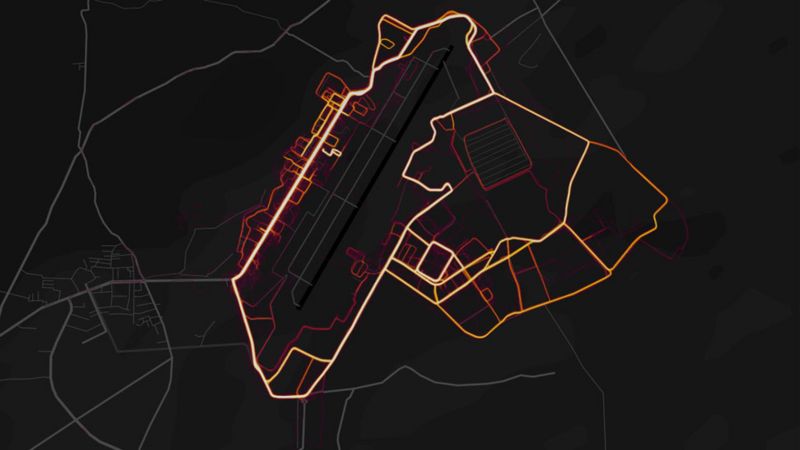
Online fitness tracker Strava ublished a "heatmap" showing the paths its users log as they run or cycle. It appears to show the structure of foreign military bases in countries including Syria and Afghanistan as soldiers move around them. Read more
Tool for Tracking Amazon Fires
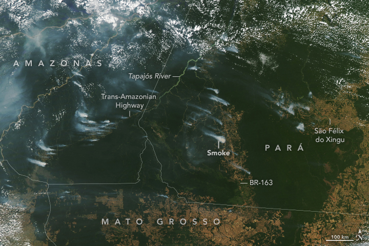
Satellites detect large numbers of fires in South America every year, but not all of these fires are of equal importance. The most problematic fires are deforestation and understory fires, which do the most lasting damage to intact rainforests. Providing more information about fire types and locations in real time will give decision-makers better information needed to manage and respond to fires. Read more
Blanked-Out Spots On China's Maps Helped Uncover Xinjiang's Camps
Baidu offers a satellite map service much like Google's or Microsoft's. Based in China, it is subject to rigorous censorship.
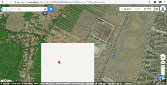
By comparing conspiciously blanked-out areas on Baidu Maps to the corresponding regions in western mapping services, we can find what the Chines government is trying to hide.

Buzzfeednews used those locations to find a network of buildings bearing the hallmarks of prisons and internment camps in Xinjiang. Read more
This is not exclusive of Chinese, and Wikipedia hosts a list of satellite map images with missing or unclear data