ShipVizUseCases - UCL-ShippingGroup/shipviz GitHub Wiki
Note this wiki is under construction.
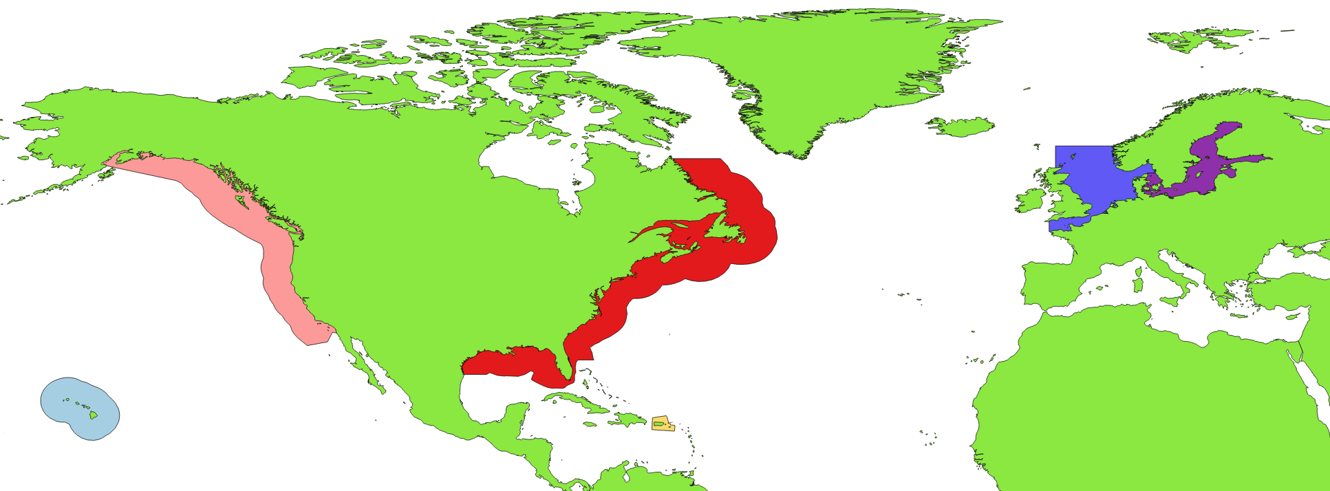
###ECA areas A shapefile containing the US ECAs and the EU ECAs is needed to perform filtering on vessels that have crossed the boundaries of those areas.
Part of the process has been documented in issue #17. The resultant shapefiles have been stored in this repo, together with the a shapefile describing continental land boundaries.
The continents shapefile has been used to filter out the part of the ECAs that is overlapping continental land, including lakes. This shapefile is not a very precise description of the boundaries, so it's likely the process of filtering out the land subarea needs to be repeated when a better description of the continents is found. In order to do that, these are the steps that need to be followed:
- Open QGIS.
- Import the unfiltered ECAs shapefile: Layer -> Add Layer -> Add Vector Layer. Browse for "ECAs.shp".
- Repeat process for the continents shapefile.
- To remove the continental area from the ECAs: Vector -> Geoprocessing Tools -> Difference. Select the continent layer as input and the ECAs layer as difference. Save the results in another shapefile and click OK.
That's it!
These are the 6 ECAs displayed in QGIS:
