Hazard Route Toolbox - Jaron-U/GIS-based-Analysis-Tool-for-Disaster-Recovery GitHub Wiki
Direct Hazard Route Toolbox
The Direct Hazard Route Toolbox is one of the python toolboxes interfaces we developed to use the Open Routing Service routing capabilities in ArcGIS Pro. This page provides an overview on the usage of the toolbox. For setting up an Open Routing Service instance see the guide page on our wiki.
Setup:
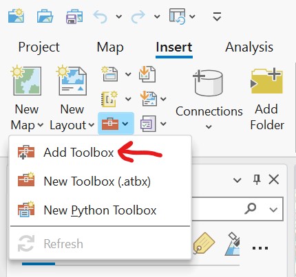
To use the toolbox in your ArcGIS Pro project you'll need to add the python toolbox in your ArcGIS Pro project:
The toolbox is guaranteed to work in ArcGIS Pro version 3.0, prior versions of ArcGIS Pro have not been tested.
Usage:
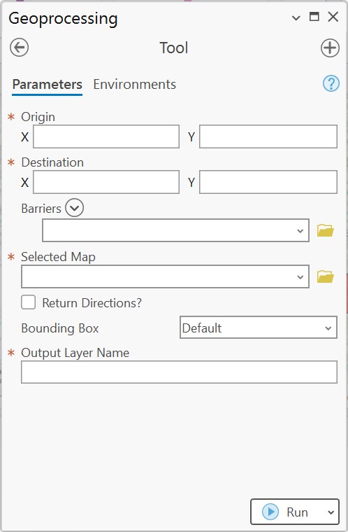
To use the Hazard Routing toolbox you need to supply at least a origin, destination, a map resource and the name of the output layer.
-
Origin & Destination parameters take in longitude and latitude coordinates in WGS 1984 format (the same format used by Google Maps if you copy coordinates from there). The toolboxes take the longitude as the "X" parameter, with the latitude expected in the "Y" parameter.
-
The Barriers parameter is an optional variable length list of Feature Layers containing barrier polygon data. To take into account hazard data to avoid, the data needs to exists as polygon features within a Feature Layer included in the "Barriers" parameter.
-
The Return Directions? is an optional parameter comprising of a check-box which will return directions as meta-data in the added feature layer when checked.
-
The Bounding Box parameter is included as an optimization measure. The Open Routing Service can only include so many polygons in a request, and oftentimes feature layers include extraneous polygons that don't impact the route. The bounding box parameter specifies a boundary for which only polygon data in the feature layers within the bounding box will get included in the Open Routing Service API request.
-
The Output Layer Name parameter is a required parameter which will specify the name of the newly generated layer. IMPORTANT: If a layer already exists in the project with the same name, it will be overwritten!
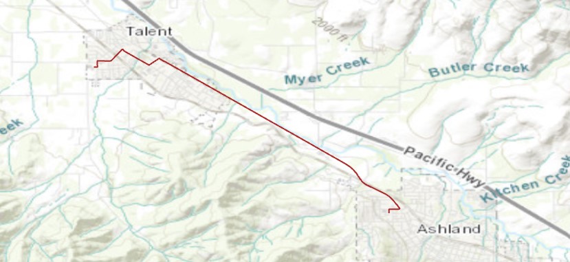
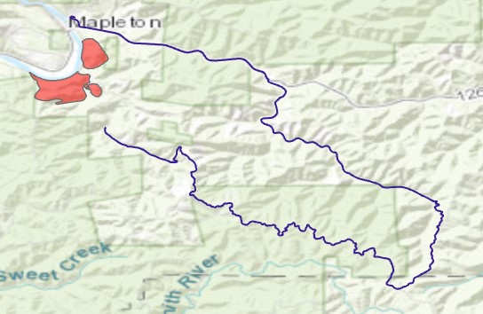
Output Examples: