MapInfo - JOverseer/joverseer GitHub Wiki
Map Information
The map displays various kinds of information. More specifically, each hex displays:
| The terrain, using the background color of the hex |  |
|---|---|
| The hex features, such as rivers, bridges and roads |  |
| Not visible hexes (i.e. not reported on the map and not seen by recon/scry) are shown with dashed lines |  |
| Alternatively, not visible hexes may be shown with a small "x" according to preferences |  |
| The population center nation (shown by the color), size, fortifications (North Gondor Town Tower) |  |
| Hidden population centers are shown with dashed lines |  |
| Capitals are denoted with small flags (Dark Lieutenant capital) |  |
| Ruins are shown, along with existing fortifications | 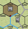 |
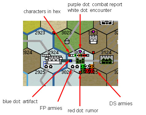
| Characters located in the hex are shown with small colored (according to nation) dots right below the hex number (three Dragon Lord and one Fire King characters at Dol Guldur) |  |
| Dragons are depicted like characters, but with a black bottom right corner (dragon at an Ice King camp) |  |
| Armies are shown in the bottom part of the hex, colored by nation. FPs are shown at the left, DS at the right, Neutrals are shown on either side (one Eothraim and one Dark Lieutenant army showing) |  |
| Whenever possible, armies are depicted as infantry or cavalry (infantry and cavalry armies at Dol Guldur) |  |
| Navies are shown with a triangle in the bottom right corner |  |
| Anchored ships are also shown |  |
| A red dot is shown in the bottom part of the hex if there is a rumor |  |
| A purple dot is shown on the top part of the hex if a combat took place |  |
| A white dot is shown on the top part of the hex if there was an encounter or challenge there |  |
| A blue dot on the left side of the hex shows the existence of an artifact (LA'ed or LAT'ed there) |  |
The following figure shows some of this information:
This page is referenced from jOverseer as MapInfo.