ILWIS Objects overview - 52North/IlwisCore GitHub Wiki
Ilwis objects form the core of the framework. They describe the main spatial datastructures and their supporting properties. Roughly speaking, functionality wise
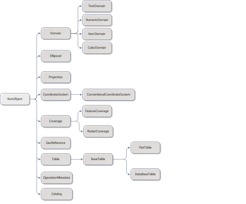
| Domain | Data type, or more correctly. The relation between internal values and their external representation |
| Ellipsoid | Mathematical approximation of the earth surface |
| Projection | Mathematics of coordinate transformations |
| CoordinateSystem | Reference system for uniquely defining spatial positions |
| Coverage | spatialt related data |
| RasterCoverage | one or more regular, equispaced grids which are spatially identically referenced |
| FeatureCoverage | a set of "things" with one or more spatial locations and a optional a set of attributes |
| Georeference | Mathematics to transform world coordinate to grid coordinates (raster) and vice versa |
| Table | Tabular data |
| OperationMetadata | Description of an operation: input and output,functionality and keywords |
| Catalog | Description of ilwis-objects in a container (e.g. folder, service) |
The picture below gives a quick overview of the available Ilwis-objects.
Each IlwisObject has a location and a type uniquely identifying it. A location can be folder on disk, a URL in a service catalog (e.g. wfs), a link to ftp data, etcetera. Each combination can exist only once in one instance of the framework. This means that all 'copies' of an objects single instance are in reality the same object. This ensures automatic consistency of data across the system with the down side of needing some extra administration for this. This administration is controlled by the master-catalog.