FeatureCoverages - 52North/IlwisCore GitHub Wiki
Featurecoverages are collections of features that share a spatial relation (e.g. being in the same area)
The property that distinguishes features from other data-tuples is that it contains a spatial property. It has a place(or more than one). It makes sense to use this property for GIS purposes as main organizational property. The concept that does this is the feature-coverage, a collection of features.There might be ( and mostely there are ) other relations that limit the membership to this collection but the spatial relation always holds and is true.
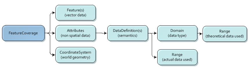
A FeatureCoverage is derived from the coverage class and is basically a set of features within certain coordinate bounds. Apart from that there is the per-feature and/or per geometry non spatial data which is kept in the attribute table(s).
There is no direct way to access the features ( the FeatureIterator is doing this). Basically the class is meant to access the general properties of a set of features
- how many
- which types (and how many)
- what type of geometries are created. At the moment it generates non-topological geometries, but potentially it could generate geometries with a full topology.
- It serves as data-source for the feature iterator
Features in a featurecoverage have a unique feature-id. This id is only valid on runtime but it uniquely identifies each feature within the framework at that moment (even with respect to other featurecoverages).
Note that the featurecoverage is not limited to holding one type of geometry per coverage. Point, lines and polygons may happily share the same feature coverage
Each feature has one geometry (which maybe of the multi type) and zero or more sub features ( see Features(s). So a feature that describes a country has for example its boundaries as geometry and could have as sub-features its provinces. Each province is a full feature so it has a geometry ( boundary probably) and could have as sub features the counties in the province. Etcetera. In theory a single feature could contain the whole world. The different levels of features are usually referred to as indexes. Each feature index level has its own set of attributes. There is no attribute table per se, though the attributes of each index could be represented as a table