Styles - HighDesertDrew/QGIS_Quick_Tutorials GitHub Wiki
Styles
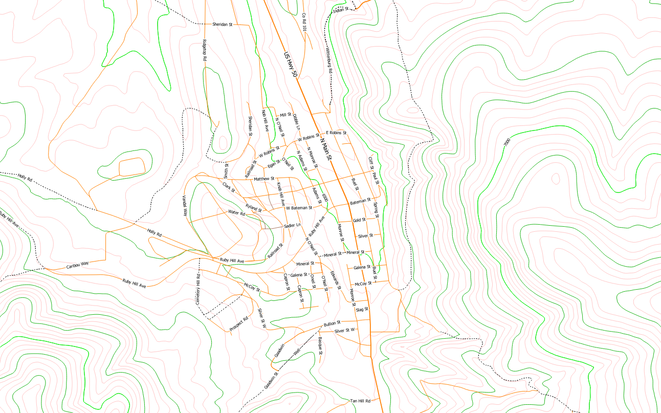
Styles Folder contains .qml files that alter the display style of Roads and Elevation data based on a series of rules and fields in the shapefiles (either SHP or GPKG). These were uploaded so users could either use them directly, or check their work when creating their own style sheets.
Design
These styles have a color scheme that was intended to be viewed under white or red light for day and night viewing. Under red light, the finer contour lines are intended to disappear while the heavier 100ft and 500ft green lines are intended to stick out more. There are several rules-based labeling options for 100ft and 500ft contours. Depending on eventual map scale, and variability in the map, it may be desirable to use one scale over the other, both are included.
The roads are colored orange and have varying line weights and labels based on road type and capacity (MTFCC). Nothing smaller than a Dirt Road (MTFCC S1400) are labeled. The MTFCC coding is built into the TIGER/Line files.